

12 Best Day Hikes Near Kathmandu
Twelve day hikes you can reach from Kathmandu by local bus in a single day out — distances, ascent, trailhead fares and what each hike is actually good for.
NepGem team · Local guides and trip planners
· 15 min read

Co-authored with a NepGem licensed trekking guide (licence no. on file) · Last verified: September 2026
You do not need a multi-day permit or a Lukla flight to get a real hike in the hills around Kathmandu. Twelve routes on the valley rim and just beyond it can be started and finished the same day, using local buses that already run from the city centre, for a total cost usually under USD 10 including entry fees. This guide is the companion piece to the full Kathmandu travel guide: that article covers the city, this one covers the half-day and full-day escape from it.
Most of these hikes climb the forested rim that rings the Kathmandu valley, at altitudes between 1,750 m and 2,762 m, so none of them carries any altitude-sickness risk. What they do carry is genuine ascent, real forest, and in most cases a first unobstructed view of the Himalaya once you clear the valley haze, usually above 2,200 m and usually before 9 a.m.
Pick by time available
Match the hike to the hours you actually have, not the hours you wish you had. Kathmandu's traffic eats the start and end of a day faster than the walking itself does, so build in more transit time than the distance suggests.
| Time available | Best picks | Round-trip time from Ratna Park |
|---|---|---|
| Half day (3 hrs walking) | Sundarijal–Mulkharka, Jamacho (main gate loop), Champadevi from Hattiban | 4–5 hrs door to door |
| Most of a day (5 hrs walking) | Shivapuri, Phulchowki, Nagarjun forest ridge, Chandragiri | 6–8 hrs door to door |
| Full day, early start (7+ hrs walking) | Nagarkot–Changunarayan, Chisapani, Kakani, Namobuddha loop, Dhulikhel–Panauti | 9–11 hrs door to door |
The three-hour column suits a jet-lagged first or last day in the city. The seven-hour column needs a 6 a.m. start from your guesthouse to leave a buffer for the bus back before dark, since none of these trails is lit and several cross forest known for leopard activity at dusk.
The twelve
Each of these can be walked in a single day from central Kathmandu. Distances and times below are for a fit adult walking at a normal pace, not a trail-running pace.
Shivapuri is the classic, and the one to do first if you only do one. From the Panimuhan gate above Budhanilkantha, it is roughly 8 km and 900 m of ascent to the 2,732 m summit ridge, 5–6 hours round trip. Reach the gate by local bus from Ratna Park toward Budhanilkantha (approximately NPR 30, 45 minutes) then a 20-minute walk or short taxi to the entrance. Entry to Shivapuri Nagarjun National Park costs approximately NPR 561 for foreign visitors including VAT as of the 2026 season — verify the current fee at the gate before you travel. Water points exist at the ranger checkpoints but not on the upper ridge, so carry at least 1.5 litres. Go for the forest itself: this is the last stretch of genuine mid-hill oak and rhododendron forest inside Kathmandu's municipal boundary, and langur monkeys are a near-certainty.
Nagarjun (main gate loop) sits inside the same national park's western block, entered near Balaju rather than Budhanilkantha. The loop to the Jamacho viewpoint and back is about 6 km with 500 m of ascent, 3 hours round trip. A local bus from Ratna Park to Balaju costs roughly NPR 20, then it is a 15-minute walk to the gate. The same national park fee applies. Go for the shortest genuine forest hike reachable from central Kathmandu — this is the pick for a spare afternoon.
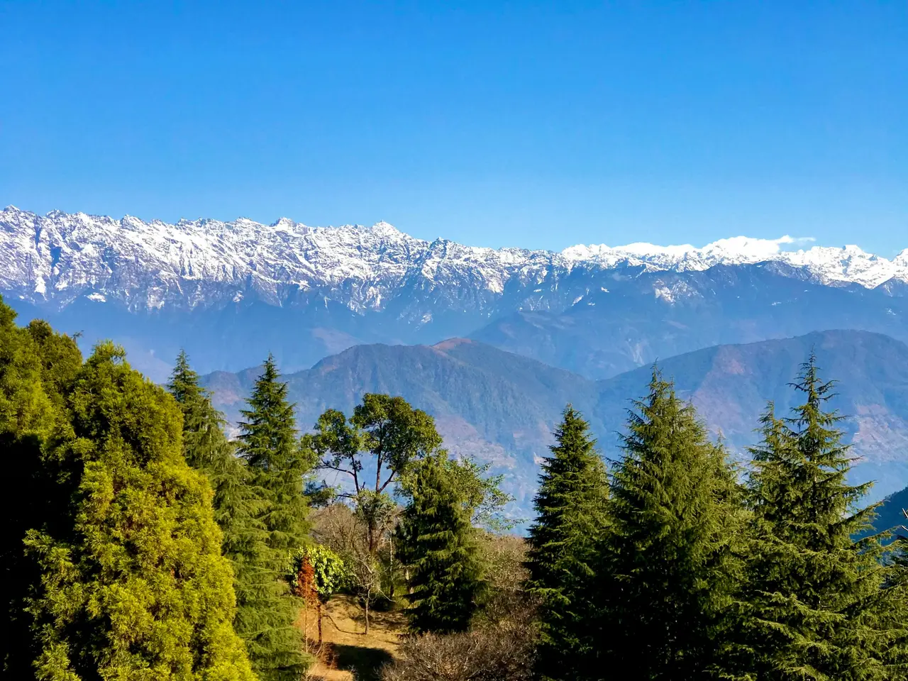
Champadevi rises to 2,249 m above Hattiban and Pharping, southwest of the city. From the Hattiban trailhead it is about 5 km and 550 m of ascent, 4 hours round trip. Take a local bus from Ratna Park toward Pharping or Dakshinkali (approximately NPR 40–60) and get off at Hattiban, then follow the dirt road uphill to the trail sign. There is no formal park fee on this route, though a small community-forest contribution is sometimes collected. Water is available at a teahouse roughly halfway up. Go for the ridge-top panorama that takes in both the Kathmandu valley and, on a clear post-monsoon morning, the Annapurna and Ganesh Himal skylines at once.
 [PHOTO]
Phulchowki is the highest point on the Kathmandu valley rim at 2,762 m, above the town of Godawari. On foot from the Godawari botanical garden gate it is about 9 km and 900 m of ascent on a jeep track shared with occasional traffic, 5–6 hours round trip. A local bus from Ratna Park's Old Bus Park to Godawari runs about NPR 40–50 and takes roughly 90 minutes. Entry to the botanical garden costs a small separate fee, typically a few hundred rupees for foreign visitors. Go in March or April for one of the best rhododendron displays in the valley, or on a clear winter morning for the widest single Himalayan panorama visible from any point this close to Kathmandu, spanning from Dhaulagiri to Everest on the best days.
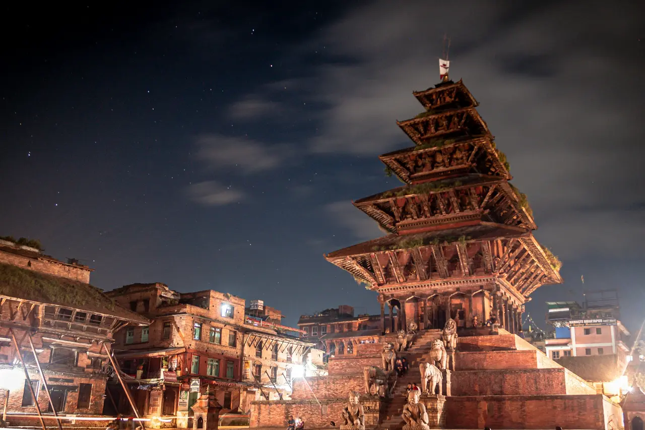
Nagarkot–Changunarayan trades a summit for a ridge walk between two well-known points, and it is the single most rewarding half-day-effort hike on this list. Start at Nagarkot (2,175 m), reached by direct local bus or microbus from Kathmandu's City Bus Park (approximately NPR 100–120, 2 hours), and walk the roughly 10 km ridge trail down through pine forest and terraced villages to Changunarayan (about 1,541 m), a UNESCO World Heritage temple site with its own microbus connection back to Kathmandu or on to Bhaktapur. Allow 4–5 hours walking. There is no separate trail fee, only the Changunarayan temple entry fee at the end. Go for sunrise from Nagarkot over the Langtang and, on the clearest days, the eastern Everest range, then a full day of downhill walking through Newar farming villages that see very few foreign hikers.
 [PHOTO]
Chandragiri reaches 2,551 m southwest of the city above Thankot. Most visitors ride the cable car from Thankot, but the hiking route climbs from the same base station, about 5 km and 700 m of ascent, 3–4 hours round trip on foot. A local bus from Kalanki toward Thankot or Naubise costs roughly NPR 30–40. Skipping the cable car and walking both ways is the honest way to do this one: the summit area is developed with a restaurant and viewing platforms, which some hikers find detracts from the hill itself, so treat the walk up as the main event rather than the summit facilities.
Chisapani sits at about 2,140 m on the ridge north of Shivapuri, and functions as either a standalone out-and-back or the first stage of the five-day Kathmandu valley rim trek. As a single day from Sundarijal it is roughly 10 km and 850 m of ascent one way, which makes the round trip a long day (7–8 hours); many hikers instead take a taxi partway up to Mulkharka to shorten it. Reach Sundarijal by local bus from Ratna Park (approximately NPR 40–50, 45–60 minutes). The Shivapuri Nagarjun National Park fee applies. Go for a genuine ridge camp feel without an overnight commitment, and for the clearest view on this list of the Jugal Himal to the northeast.
Sundarijal–Mulkharka is the short version of the Chisapani approach and the easiest genuine forest walk on this list. From the Sundarijal water-intake gate to Mulkharka village is about 3 km and 400 m of ascent, 2–3 hours round trip, on the same bus route as Chisapani above. It suits a half day, a first hike for children, or a warm-up walk the day before a longer trek. Water and tea are available at Mulkharka.
Kakani lies northwest of the valley at about 2,073 m and is one of the least crowded hikes on this list precisely because it needs a slightly longer bus ride. From Balaju or Machha Pokhari, a local bus toward Kakani or Trishuli costs roughly NPR 80–100 and takes about 90 minutes; the walk itself from the bus stop to the viewpoint ridge is short, under 2 km, but the setting rewards a full morning. Go specifically for the Ganesh Himal and Langtang range view, which from Kakani's angle is arguably clearer than from any point on the eastern side of the valley rim, and for the working terraces and apple orchards on the approach.
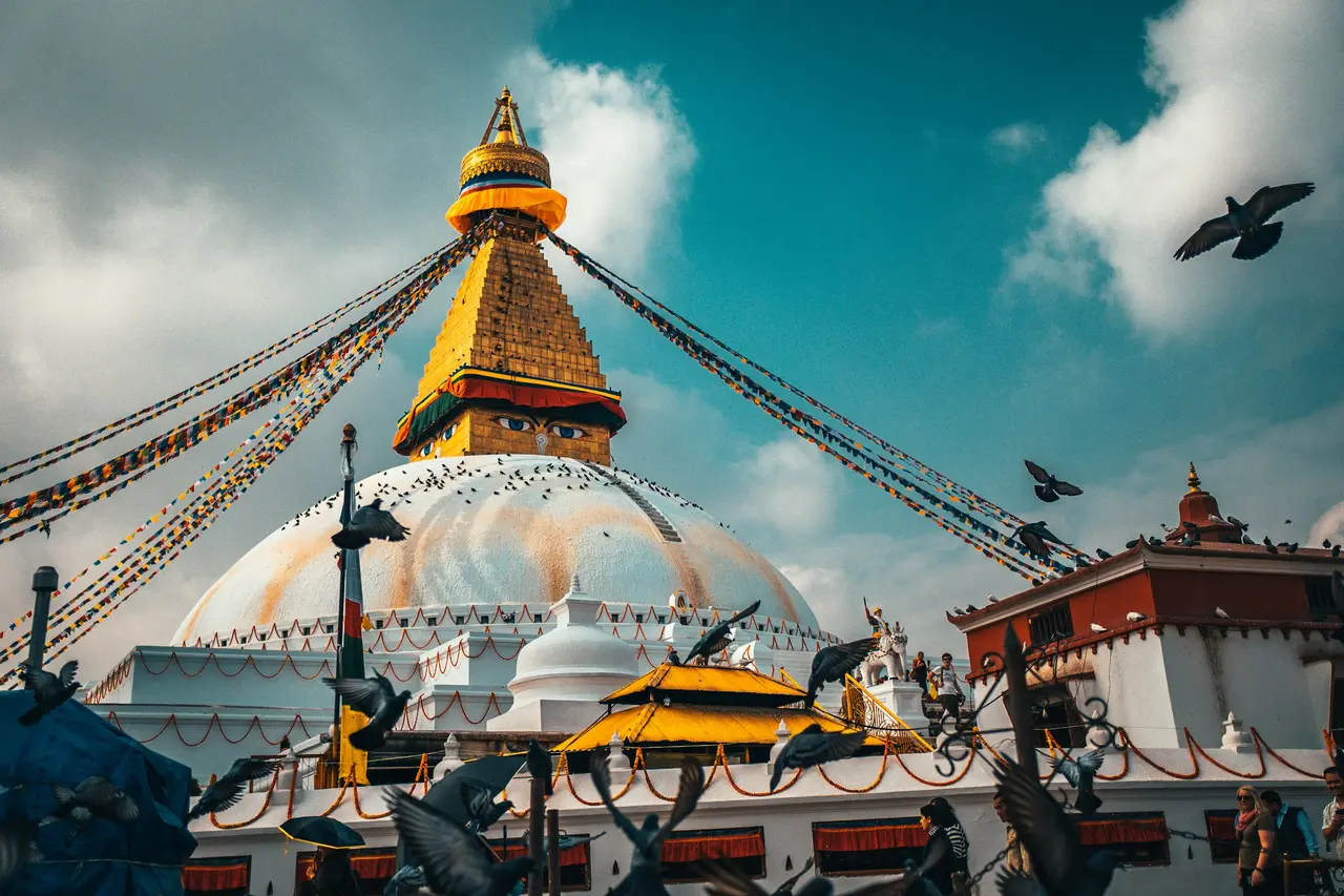
Namobuddha combines a hike with one of the valley's most significant Buddhist sites, a monastery and stupa complex at about 1,750 m east of Dhulikhel, associated with a jataka tale of self-sacrifice that predates most of the valley's other pilgrimage sites. Reach it either by direct microbus from Ratna Park (approximately NPR 100–150, 2 hours) or by bus to Dhulikhel followed by a 2-hour walk through Newar farming villages, which is the better version of the day. Go for the monastery itself, active with maroon-robed monks and prayer wheels rather than staged for visitors, and for the Dhulikhel–Namobuddha walking connection described below.
 [PHOTO]
Dhulikhel–Panauti links two of the valley's best-preserved Newar towns on foot, about 15 km through terraced farmland and pine ridges with roughly 400 m of net descent, 4–5 hours walking. Take a bus from Kathmandu's City Bus Park to Dhulikhel (approximately NPR 100, 90 minutes), walk to Panauti, then catch a local bus or microbus back from Panauti's bus stand. Go for the architecture rather than the altitude: Panauti's Indreshwar Mahadev temple courtyard is one of the least visited significant temple complexes in the valley, and the walk between the two towns passes through villages with almost no tourist infrastructure at all.
 [PHOTO]
Jamacho (Ichangu Narayan route) is the longer, quieter approach to the same hilltop monastery reached from Nagarjun's main gate above, but starting instead from the Ichangu Narayan temple on the valley's northwest edge. It is about 9 km and 750 m of ascent, 5 hours round trip, through denser forest with far fewer other hikers than the main-gate route. Reach Ichangu Narayan by local bus and a short walk from the Balaju–Nagarjun road. The same national park entry fee applies once you cross into the reserve. Go for solitude on a route that shares a summit with one of the most popular short hikes in the valley but sees a fraction of the traffic.
Getting to trailheads without a car
This is the part almost nobody writes clearly, and it is the difference between a hike costing USD 1–2 each way and one costing USD 15–25 in taxi fares. Kathmandu's local bus and microbus network reaches every trailhead on this list, and understanding how to use it is worth ten minutes before your first hike.
Buses and minibuses to the valley rim leave from a handful of hubs rather than a single station: Ratna Park (also called the New Bus Park area near the old city) covers Sundarijal, Budhanilkantha, Godawari and most southern and eastern routes; the City Bus Park near Bagh Bazaar covers Nagarkot, Dhulikhel and Banepa-direction routes; Balaju's local stand covers Nagarjun, Kakani and the northwest. Vehicles have their destination painted on a board above the windscreen in Devanagari script, and the conductor calls the destination out of the door while the bus is loading, so listen for the place name rather than trying to read the board from a distance.
Fares on these routes are fixed by the operators' association and paid in cash to the conductor during the ride, typically NPR 20–150 depending on distance; keep small notes, since conductors often cannot break a NPR 1,000 note. Buses do not run to a fixed timetable on most of these routes; they leave when reasonably full, which means departures cluster in the early morning (6–8 a.m.) and again in the afternoon, with a thinner service in between. Plan to arrive at the stand rather than expecting a bus at a specific minute.
A ride-hailing app (Pathao or InDrive both operate in Kathmandu) is the practical middle option when a bus route is inconvenient or you are travelling with young children or heavy camera gear: expect roughly NPR 400–700 to reach most of the trailheads above from central Thamel, a fraction of a private taxi's asking price and far more predictable than flagging one down. Always confirm the fare or use the app's metered estimate before the ride starts, since unmetered street taxis routinely quote foreign visitors two to three times the local rate.
Safety, dogs, and monsoon leeches
The honest risks on these hikes are dogs, disorientation on unmarked forest junctions, and, from June to September, leeches — not altitude or technical terrain. Treat all three plainly rather than as an afterthought.
Village and forest-edge dogs are common on every route above, and most are territorial rather than aggressive; carrying a stick, walking in a small group, and avoiding direct eye contact with a barking dog resolves the great majority of encounters. Rabies exists in Nepal's dog population, so any bite, even one that does not break the skin, should be washed immediately and followed up with a doctor in Kathmandu the same day rather than waiting to see if symptoms appear.
Trail junctions inside Shivapuri Nagarjun National Park and on the Nagarkot–Changunarayan ridge are not consistently signed, and several routes cross logging tracks that look like the main trail. Carrying a downloaded offline map (Maps.me or Gaia GPS both cover these trails reasonably well) and telling someone your planned route and return time costs nothing and has saved more than one disoriented hiker a cold night out. Mobile signal is patchy but not absent on most of these ridges.
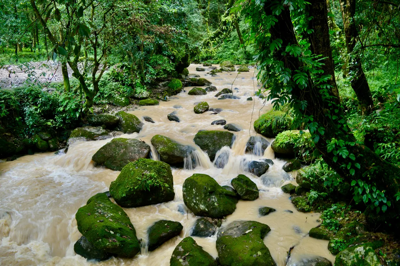
Monsoon season (roughly June to early September) brings out land leeches on the wetter, more forested routes, particularly Shivapuri, Nagarjun and Phulchowki. They are unpleasant rather than dangerous: tucking trousers into socks, using a leech-repellent spray or a strong salt solution on boots, and checking exposed skin at rest stops keeps bites to a minor nuisance. If you are planning around this list specifically for the monsoon months, read the fuller picture on trekking Nepal in monsoon season before you commit to a wet-season itinerary, since visibility on the higher viewpoints (Phulchowki, Champadevi, Kakani) is also much reduced by cloud in these months.
None of the twelve hikes above requires technical equipment, ropes, or specialist gear. Sturdy trail shoes, 1.5–2 litres of water, a headtorch kept in the bag even on a planned daylight return, and a basic first-aid kit cover every route on this list.
Guided or solo?
Every hike above can be walked solo by a reasonably fit adult with the route notes given, and most local and foreign hikers do exactly that. A local guide earns their day rate on this list for three specific reasons rather than as a blanket recommendation: unmarked junctions on Shivapuri, Nagarjun and the Ichangu Narayan approach to Jamacho where a wrong turn costs an hour; cultural context at Changunarayan, Namobuddha and Panauti that turns a walk past a temple into an explanation of what you are actually looking at; and language, since bus conductors, teahouse owners and rangers along these routes speak limited English outside the most touristed stretches.
A day guide for a Kathmandu valley hike typically costs USD 25–35 for the day, including their own transport and lunch, which is a fraction of a multi-day trekking guide's rate because there is no altitude risk, no remote logistics and no overnight component to plan around. For a family with children, a first-time solo female traveller, or anyone hiking Chisapani or the longer Jamacho approach where the trail is quieter and less trafficked by other hikers, that cost buys a meaningfully safer and more informative day. If you are planning to bring children along, see hiking in Nepal with kids for which of these twelve routes suit younger legs and which don't.
FAQ
Where can I hike near Kathmandu in one day? Shivapuri, Champadevi and the Nagarkot–Changunarayan ridge are all doable as day trips by local bus from central Kathmandu. Each combines several hours of genuine forest or ridge walking with a clear Himalayan view once you climb above the valley's usual haze, typically above 2,200 metres.
Is hiking near Kathmandu safe alone? Yes, for most of these routes, with sensible precautions. Territorial dogs, unmarked forest junctions and, in monsoon months, leeches are the real risks rather than altitude or technical terrain, so carry an offline map, tell someone your return time, and treat any dog bite promptly at a Kathmandu clinic the same day.
Do you need a permit for Shivapuri? Yes. Shivapuri sits inside Shivapuri Nagarjun National Park, which charges a national park entry fee of approximately NPR 561 for foreign visitors as of the 2026 season, payable at the ranger gate. The same fee applies to the Nagarjun and Jamacho routes inside the same protected area.
What's the best hike for mountain views? Phulchowki or Chandragiri give the widest single Himalayan panoramas reachable from central Kathmandu in a day. Phulchowki, at 2,762 m, is the valley rim's highest point and on a clear post-monsoon morning shows a range spanning from Dhaulagiri to the Everest massif.
Hire a guide for the day, not the whole trip
None of these twelve hikes needs a multi-day booking or a big commitment, which makes a day guide the easiest first purchase to make on NepGem before you commit to anything longer. You see the guide's licence number, the routes they actually know well, and reviews from other travellers who have done the same half-day or full-day hike, before you pay a deposit for a single afternoon. If Shivapuri, Nagarkot–Changunarayan or the Ichangu Narayan approach to Jamacho goes well, the same guide profile carries straight through to booking a multi-day trek later, so you are not starting the vetting process over from nothing once you are ready for Poon Hill, Langtang or Everest Base Camp. Hire for the day you actually have in Kathmandu; decide about the rest of the trip afterwards.


