

Everest Three Passes Trek: Kongma La, Cho La and Renjo La
Twenty days, three passes above 5,300 m, and every major viewpoint in the Khumbu — the hardest non-technical trek in the Everest region, done properly.
NepGem team · Local guides and trip planners
· 16 min read

Co-authored with a NepGem licensed trekking guide (licence no. on file) · Last verified: September 2026
The Everest Three Passes trek links Kongma La (5,535 m), Cho La (5,420 m) and Renjo La (5,360 m) into a single 20-day circuit that visits every major viewpoint in the Khumbu — Everest Base Camp, Kala Patthar and the Gokyo lakes — without repeating a day's walking. It is the hardest non-technical trek in the Everest region, harder in cumulative demand than the everest base camp trek it builds on, and it exists for trekkers who have already done a standard Himalayan trek and want the fuller version rather than the highlights reel. This is not a trek to attempt as a first exposure to altitude; it is the trek people plan after Everest Base Camp or Annapurna Circuit leaves them wanting the parts those itineraries deliberately route around.
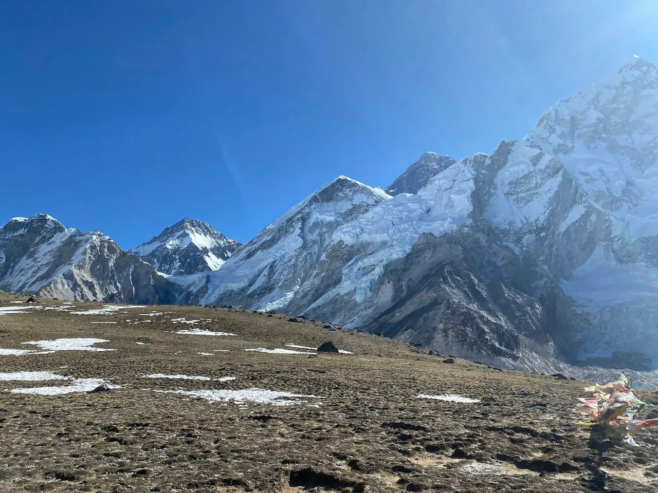 [GEN]
What the Three Passes is, and who it's for
The Three Passes trek is a 20-day circuit through the Khumbu that crosses three passes above 5,300 m and connects the Chhukung, Everest Base Camp and Gokyo valleys into one continuous route, rather than treating them as separate out-and-back trips. It asks considerably more of a trekker than the standard Everest Base Camp itinerary: three summit-level exertion days instead of one, sustained time above 5,000 m rather than a single night near it, and a genuine requirement for prior high-altitude experience.
NepGem's honest prerequisite, and one worth stating plainly rather than softening: trekkers attempting the Three Passes should already have completed at least one trek reaching 5,000 m or higher — Everest Base Camp, Annapurna Circuit's Thorong La, or an equivalent — before attempting this circuit. That prior exposure matters for two reasons. First, it gives you and your guide real data on how your body handles altitude above 5,000 m, rather than discovering it for the first time on a pass with no easy retreat. Second, the fitness and pacing habits built on a first high-altitude trek — how fast to walk, how much to eat, when a headache is normal and when it isn't — are assumed knowledge on this itinerary rather than something taught from scratch. Trekkers without that baseline are not turned away, but NepGem guides will typically recommend Everest Base Camp or Gokyo Lakes first and the Three Passes as a follow-up trip in a later season.
The trek also differs from a standard Khumbu itinerary in how it treats time. A standard Everest Base Camp trek gives you one shot at a summit-style push — the Kala Patthar sunrise — and builds the rest of the itinerary around getting to and from it safely. The Three Passes trek asks for three of those pushes, spaced roughly three to five days apart, each preceded by its own acclimatisation requirement and each carrying its own weather-dependent go/no-go decision. That repeated cycle of exertion, recovery, and high-stakes decision-making is what genuinely separates this trek from a longer version of Everest Base Camp rather than a harder one in the same category. Trekkers who found the single Kala Patthar morning the highlight of a previous Everest trip, rather than simply an ordeal to get through, tend to be the ones who enjoy the Three Passes rather than merely surviving it.
Direction matters: why anti-clockwise
The Three Passes trek can be walked in either direction, but crossing Kongma La first, from the Chhukung side, then Cho La, then finishing with Renjo La is the direction NepGem itineraries default to, and the reasoning is both physiological and practical. Kongma La is the technically hardest and highest of the three passes, and tackling it early in the trek means crossing it while legs are freshest and before three weeks of cumulative fatigue set in — a meaningful difference on a pass whose descent is a long, loose boulder field rather than a maintained trail.
The acclimatisation curve also favours this direction. Approaching Kongma La via Dingboche (4,410 m) and Chhukung (4,730 m) means the body has already spent two nights above 4,400 m and completed at least one acclimatisation side hike before the first pass, which is a more gradual build-up than approaching from the Gokyo side, where the altitude gain to Renjo La is comparatively steeper for a trekker not yet acclimatised. Finishing with Renjo La, widely agreed to be the easiest technically of the three passes, also means the trek's most physically demanding obstacle is behind you well before the final stretch, rather than saving the trickiest terrain for when three weeks of trekking fatigue has accumulated. Reversing the direction is possible and some operators run it that way, but doing so means crossing Kongma La — the pass with the least margin for error — at the point in the trip when a trekker is most tired.
Day-by-day: 20 days
The itinerary below is the standard anti-clockwise Three Passes circuit, including two contingency days for Lukla flight delays, which affect this itinerary more than most given the total number of days at stake if a crossing gets weathered out.
| Day | Route | Overnight altitude |
|---|---|---|
| 1 | Fly Kathmandu → Lukla, trek to Phakding | 2,610 m |
| 2 | Phakding → Namche Bazaar | 3,440 m |
| 3 | Acclimatisation day, side hike to Khumjung or the Everest View Hotel | 3,440 m |
| 4 | Namche → Tengboche | 3,860 m |
| 5 | Tengboche → Dingboche | 4,410 m |
| 6 | Acclimatisation day, side hike up Nangkartshang Ridge | 4,410 m |
| 7 | Dingboche → Chhukung | 4,730 m |
| 8 | Chhukung → Kongma La → Lobuche | 4,940 m |
| 9 | Lobuche → Gorak Shep, side trip to Everest Base Camp | 5,164 m |
| 10 | Sunrise on Kala Patthar (5,644 m), then Gorak Shep → Dzongla | 4,830 m |
| 11 | Dzongla → Cho La → Thangnak | 4,700 m |
| 12 | Thangnak → Gokyo | 4,790 m |
| 13 | Acclimatisation day, climb Gokyo Ri (5,357 m) | 4,790 m |
| 14 | Gokyo → Renjo La → Lungden | 4,340 m |
| 15 | Lungden → Thame | 3,820 m |
| 16 | Thame → Namche Bazaar | 3,440 m |
| 17 | Namche → Lukla, via Monjo and Phakding | 2,840 m |
| 18 | Fly Lukla → Kathmandu | — |
| 19–20 | Contingency days for Lukla flight delay | — |
Three days on this itinerary carry the trek's real weight: Day 8's Kongma La crossing, Day 11's Cho La crossing, and Day 14's Renjo La crossing, each requiring seven to nine hours of sustained effort above 5,300 m and each demanding a clear-weather call from the guide the morning of. The two rest days at Dingboche and Gokyo are not scenic bonuses — they are load-bearing acclimatisation days positioned deliberately before the first pass and before the third, and skipping either to save a day is the single most common way trekkers turn a hard trek into a genuinely risky one. Day 10's sunrise at Kala Patthar (5,644 m) remains the trek's single most photographed moment and the best vantage point on the entire circuit for Everest's actual summit pyramid — see how tall is Everest for how that 8,848.86 m figure was confirmed by the 2020 Nepal–China resurvey. The two contingency days at the end exist because a delayed Lukla flight is common enough in the Everest region that booking an international departure the same evening you're due back from Lukla is a real risk on any Khumbu itinerary, and doubly so on one this long.
The lower valley stretch, Days 1 through 7, deliberately mirrors the standard Everest Base Camp acclimatisation schedule rather than trying to accelerate it: the same Namche and Dingboche rest days, the same gradual climb through Phakding, Tengboche and the pine and rhododendron forest that gives way to juniper and dwarf birch above 3,800 m. Tengboche's monastery, the largest in the Khumbu, is worth the extra hour it takes to look around properly on Day 4 rather than treating it as a lunch stop, since the trek's later days leave little spare time for anything but walking, eating and sleeping. From Chhukung onward, the itinerary stops resembling a standard trek entirely — Chhukung itself is little more than a cluster of lodges at the head of a side valley, used almost exclusively as a staging point for Kongma La and, for climbers, Island Peak, and the change in atmosphere from Dingboche's relatively busy trail junction to Chhukung's quiet dead end is itself a signal that the trek's character is shifting.
Kongma La, 5,535 m
Kongma La is the highest of the three passes and, by consensus among Khumbu guides, the hardest — not because of technical climbing but because of a long, loose boulder field on both the ascent from Chhukung and the descent toward Khongma Danda and Lobuche. The approach from Chhukung climbs roughly 800 m over three to four hours of increasingly steep, unstable terrain to a summit marked by a chorten and a dense field of prayer flags, with views back across the Chhukung valley to Ama Dablam's north side.
The descent toward Lobuche is, if anything, the more demanding half of the day: a long, exposed scree and boulder slope that tests knees and ankles more than lungs, followed by a rocky trail down to the Khumbu Glacier's edge. Route-finding across the boulder field in cloud or fresh snow is genuinely difficult — cairns mark the way but are easy to lose track of when visibility drops — which is the main reason NepGem guides treat Kongma La as the pass requiring the clearest weather window of the three, and the one most likely to trigger a day's delay if conditions look marginal at Chhukung.
Timing matters as much as fitness on this crossing. Guides typically start well before dawn, both to cross the boulder field while the rock is still frozen and stable rather than loosened by the afternoon sun, and to reach Lobuche before the Khumbu's characteristic afternoon cloud rolls in and reduces visibility on the descent. There is no reliable water source between Chhukung and Lobuche, so the day's full water supply has to be carried from the outset, and there are no teahouses to shelter in partway across — once committed to the boulder field, the only practical way off it is to keep moving in one direction. Trekkers who have struggled with knee pain on long descents elsewhere in the Himalaya should raise it with their guide before this specific day, since the unstable footing on the descent stresses joints more than the smoother switchback trails found on the standard Everest Base Camp route.
Cho La, 5,420 m
Cho La connects Dzongla, on the Everest Base Camp side, to Thangnak and Gokyo on the western side, and involves a genuine glacier crossing that neither Kongma La nor Renjo La require. The ascent from Dzongla climbs a steep, rocky gully to the pass, after which the route crosses the Cho La glacier itself — a stretch of exposed ice and packed snow that varies substantially in difficulty by season and by how much snow has recently fallen.
In most conditions, sturdy boots and microspikes are sufficient for the glacier crossing; in icier early-season or late-season conditions, or after fresh snowfall has obscured crevasses, a guide may call for crampons or, rarely, a roped section. This is the pass where guide judgement matters most in the moment, since conditions can differ meaningfully between two crossings a week apart. The descent to Thangnak is straightforward once off the ice, and Cho La is also the pass used by trekkers doing the shorter Gokyo Lakes and Cho La trek as a standalone loop rather than the full Three Passes circuit — worth reading if you're deciding between the full circuit and this shorter, still-substantial alternative.
Dzongla itself, the staging village for the crossing, is smaller and quieter than Lobuche or Dingboche, with a handful of lodges set below a striking amphitheatre of peaks including Cholatse and Tawache. Most groups leave Dzongla in the dark to reach the pass by mid-morning and clear the glacier section before afternoon warming softens the snow surface, which is when the crossing becomes both slower and marginally more slippery. Unlike Kongma La, Cho La does have a teahouse roughly midway at Dzongla's side and another shortly after Thangnak, so the day is less logistically exposed even though the glacier itself demands more careful, deliberate footwork than either of the other two passes.
Renjo La, 5,360 m
Renjo La, crossed from the Gokyo side toward Lungden and Thame, is generally regarded as the easiest of the three passes technically, with a well-defined trail and no glacier crossing, though the ascent from Gokyo is still a sustained, several-hour climb above 5,000 m that should not be underestimated simply because it lacks Kongma La's boulder field or Cho La's ice.
What Renjo La offers in return is arguably the best single viewpoint of the entire trek: from the pass, the panorama takes in Everest, Lhotse, Makalu and Cho Oyu along the horizon, with the turquoise Gokyo lakes visible directly below on the valley floor behind you — a wider single-frame view of 8,000 m peaks than either Kala Patthar or Gokyo Ri offers alone. The descent toward Lungden and on to Thame drops through increasingly remote, lightly trekked country compared with the main Everest Base Camp trail, and Thame itself — birthplace of several well-known Everest climbers — is a worthwhile overnight stop rather than a place to rush through on the way back to Namche.
Because Renjo La sees noticeably less traffic than the main Everest Base Camp corridor, the villages either side of it — Gokyo on one flank, Lungden and Marulung on the other — retain a quieter, more agricultural character than Namche or Tengboche, where trekking tourism has reshaped the local economy over decades. The trail down from the pass toward Lungden switches back steeply for the first hour before easing into a broader valley walk, and this final crossing is often the one trekkers remember most fondly precisely because it comes after the two harder passes are already behind them — tired legs but a settled mind, on a trail that rewards rather than punishes.
Gear the standard EBC list doesn't cover
The standard Everest Base Camp packing list is a reasonable starting point for the Three Passes trek but is missing several items that matter specifically for the pass crossings, and treating this trek's gear list as identical to a standard EBC kit is one of the more common planning mistakes.
Microspikes are close to mandatory for the Cho La glacier crossing and useful insurance on the descent sections of Kongma La and Renjo La in icy conditions; a lightweight pair adds little weight and meaningfully reduces slip risk on packed snow and ice that standard trekking boot soles handle poorly. A sleeping bag rated to at least −20°C is worth the extra weight or rental cost over the −10°C to −15°C bags that suffice for a standard EBC trek, since nights at Chhukung, Dzongla and Gokyo regularly drop well below the temperatures a lighter bag is rated for. Glacier glasses or high-category sunglasses (category 4) matter more here than on EBC because of the extended time spent on snow and ice at the Cho La crossing, where standard sunglasses risk snow blindness on a bright day. Gaiters keep snow and scree out of boots on all three passes, and trekking poles fitted with snow baskets are more useful here than the standard baskets sold with most rental poles in Kathmandu. A climbing harness is not standard kit for the Three Passes and is not required in typical conditions; it is occasionally carried by guides as a precaution for the Cho La glacier in an unusually icy season, and NepGem guide profiles note when a specific guide carries this as standard practice.
Cost
A 20-day Three Passes trek costs from roughly USD 1,650 travelling solo, dropping toward USD 1,050 per person once a group of six shares the fixed costs. The guide fee sits above the standard Everest Base Camp rate because of the technical demands of the three crossings — expect roughly USD 30–35 a day rather than the USD 25 typical of a standard EBC trek — and the trip's extra length adds several nights of lodging and food compared with the shorter itinerary.
| Cost item | Amount | Shared or per-person |
|---|---|---|
| Kathmandu–Lukla flights, return | ~USD 340–380 total | Per person (flight seats don't pool) |
| Sagarmatha National Park permit | NPR 3,000 (~USD 23) | Per person |
| Khumbu Pasang Lhamu Rural Municipality fee | NPR 2,000 (~USD 15) | Per person |
| Licensed guide, 20 days, technical rate | ~USD 30–35/day | Shared across group |
| Lodging, ~17 nights | ~USD 8–12/night | Per person |
| Food, 20 days | ~USD 20–30/day | Per person |
As with every NepGem itinerary, the guide fee is the shared pool that splits across the group, while Lukla flight seats, permits, lodging and food stay fixed per person regardless of group size.
Everest Three Passes Trek: price by group sizeFAQ
How hard is the Three Passes trek? It is the hardest non-technical trek in the Everest region: 20 days including three passes above 5,300 m, each requiring seven to nine hours of sustained effort at altitude. It demands prior experience at 5,000 m or higher and considerably more cumulative fitness than the standard Everest Base Camp trek.
Which pass is hardest? Kongma La, by consensus among Khumbu guides, due to a long, loose boulder field on both the ascent from Chhukung and the descent toward Lobuche. It is also the highest of the three passes at 5,535 m and the one most likely to be delayed by a poor weather window.
Do you need crampons? Usually not — microspikes are sufficient for most Cho La glacier crossings and are useful insurance on the other two passes' icy descents. In unusually icy conditions or after fresh snowfall, a guide may call for crampons or, rarely, a short roped section on the Cho La glacier.
Can you do it without a guide? Legally and practically, no. Since April 2023 the Nepal Tourism Board has required a licensed guide for trekkers in Sagarmatha National Park, and the route-finding across three passes in cloud or fresh snow is genuinely hazardous without local, current knowledge of trail conditions that changes week to week.
Hire a guide who has actually crossed all three passes
The Three Passes trek is the itinerary in the Everest region where the individual guide's specific experience matters most, not just their licence. NepGem lets you hire the guide directly rather than an agency: you see their licence number, their altitude record, the languages they speak, and reviews from trekkers they've led on this exact route before you pay. For a trek where a single wrong call at Kongma La in worsening weather has real consequences, that is a meaningfully different guarantee than an agency assigning whichever guide is available that week. If you're weighing this circuit against a technical add-on like the island peak climb or want to build climbing skills first through a learn-to-climb course in Nepal, NepGem's guide profiles show which guides hold both trekking and climbing credentials, so you can plan the two together with one person who knows your full itinerary rather than handing off between operators mid-trip.


