

Kanchenjunga Base Camp Trek: Nepal's Hardest Teahouse Trek
Three weeks to the third-highest mountain on earth through Nepal's least-visited region, with two base camps, a three-pass link, and a mandatory guide.
NepGem team · Local guides and trip planners
· 16 min read

Co-authored with a NepGem licensed trekking guide (licence no. on file) · Last verified: September 2026
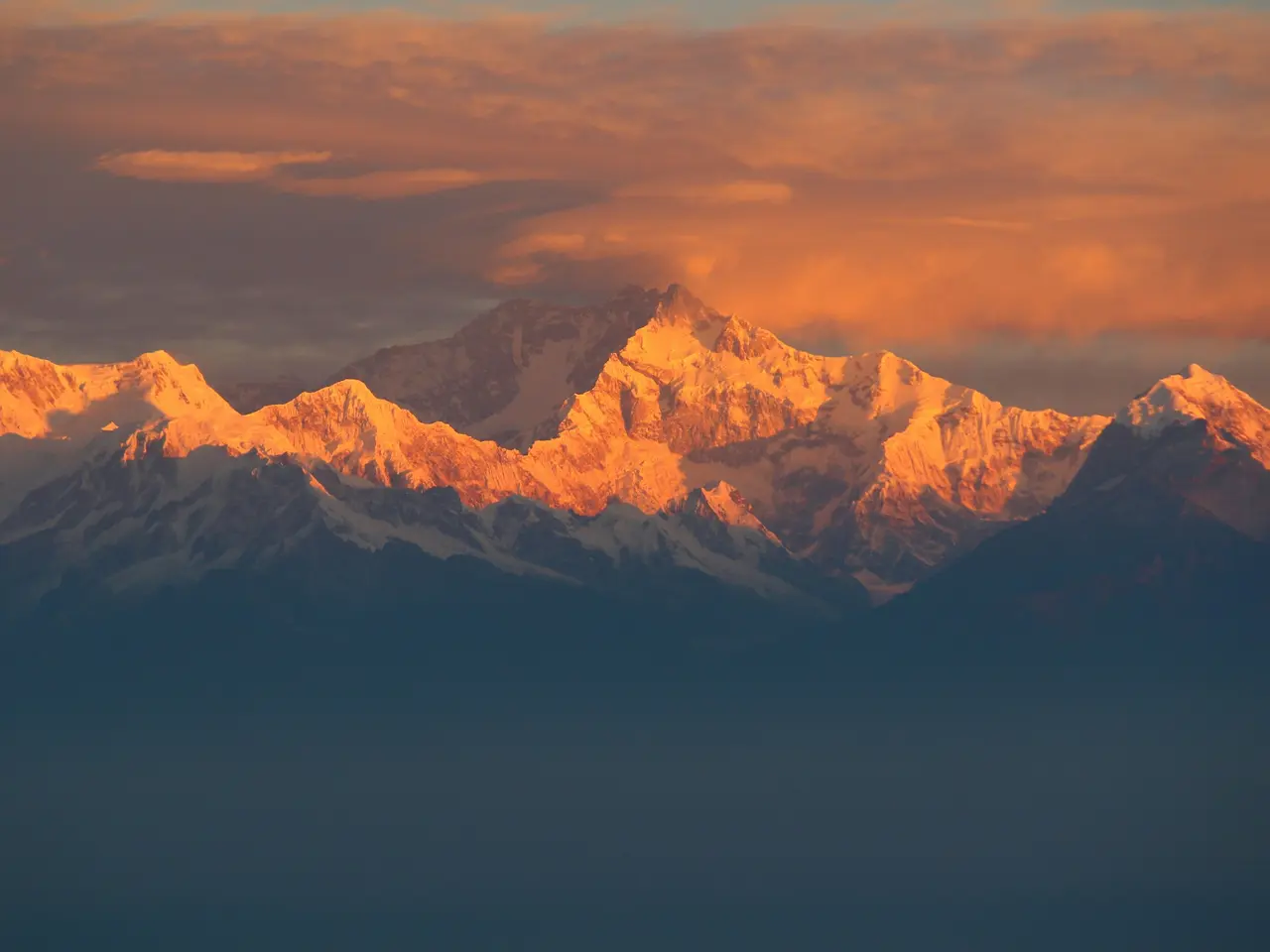
Kanchenjunga is the third-highest mountain on earth at 8,586 m, and the trek to its base camps is, by most measures, the hardest teahouse trek in Nepal — not technically, but in duration, remoteness, and the thinness of the safety net once you're past Ghunsa. Twenty-two days, two separate base camps on opposite sides of the massif, a restricted-area permit, and a legal requirement to trek with a licensed guide make this a different category of trip from the trekking routes compared list most travellers start their Nepal planning with. Fewer trekkers complete Kanchenjunga in a year than pass through Everest Base Camp in a single busy October week, and that scarcity is the entire point: this is Nepal's high Himalaya without the infrastructure, the crowds, or the mobile signal.
 [GEN]
What 22 days actually asks of you
Kanchenjunga demands more time, more logistical planning, and more tolerance for basic conditions than any of Nepal's other major teahouse treks, in exchange for a level of solitude nothing else in the country offers at this scale. Twenty-two days is the realistic full-circuit figure once you include the two travel days to and from Taplejung, acclimatisation days at Ghunsa, and a buffer day for weather — trim it and you either drop one of the two base camps or cut acclimatisation margins that matter more here than almost anywhere else in Nepal.
The honest comparison is with Manaslu: both are restricted-area circuits requiring a licensed guide and a minimum group size, but Kanchenjunga runs roughly a week longer than the manaslu circuit trek and reaches a genuinely more remote corner of the country, where the nearest road ends at Taplejung and everything past Ghunsa is on foot or by mule. Trekkers should arrive with prior teahouse-trekking experience at altitude — this is not a sensible first Himalayan trek — and with a realistic appetite for basic lodges, limited food variety in the upper valleys, and days where the plan changes because a pass is under snow or a mule train is running late. What you get in return is genuine wilderness: multi-day stretches without meeting another trekking group, forest and glacier scenery that rivals anything in the Khumbu, and two base camps that see a fraction of Everest Base Camp's annual visitor count.
Fitness preparation matters more here than for a comparable-altitude trek closer to Kathmandu, simply because the days are longer on average and the option to bail out to a road is much further away for much of the route. A trekker who can comfortably manage six to seven hours of walking a day at altitude, with a pack, for two to three weeks running, is realistically prepared; someone whose longest prior trek was five or six days should treat Kanchenjunga as a second- or third-Himalayan-trip goal rather than a starting point. The trek also asks more of your schedule flexibility than most — weather delays at the Bhadrapur flight, at the Sele La crossing, or on the Taplejung jeep road are common enough that a fixed return flight from Kathmandu booked for the day after you're due back is a genuine risk, and NepGem itineraries for this route build in at least one full contingency day beyond the 22 quoted here for exactly that reason.
North and south base camps: choosing, or doing both
Kanchenjunga has two base camps on opposite flanks of the massif, and the central planning decision on this trek is whether to visit one or both. North Base Camp, at Pangpema (5,143 m), sits beneath Kanchenjunga's sheer north face with close views of neighbouring Jannu (7,710 m) across the valley — many trekkers rate it the more dramatic of the two viewpoints. South Base Camp, near Oktang (approximately 4,730 m) above the village of Ramche, looks onto the mountain's south face and the Yalung Glacier, a broader, more open amphitheatre of ice and rock.
Doing only the north side trims the trip to roughly 16–18 days and is the more commonly chosen option for trekkers with tighter schedules, since it reaches Pangpema and returns the way it came without crossing the high pass complex linking the two sides. Doing only the south side runs a similar length via a different approach through Yamphudin, though it is less frequently walked than the north route. The full 22-day itinerary links both by crossing the Mirgin La, Sinion La and Sele La — a linked high-pass traverse sitting between 4,290 m and 4,480 m — from Ghunsa on the north side down to Tseram and Ramche on the south, meaning you see both faces of the mountain without retracing a single day's walking. That link is also the itinerary's technical crux: three passes in quick succession, at altitude, on a trail that can hold snow well into the trekking season, and the reason a serious guide with current route knowledge matters more here than on almost any other Nepal trek.
Day-by-day: 22 days via Taplejung
The standard full-circuit itinerary starts with a flight from Kathmandu to Bhadrapur in the eastern Terai, then a long road journey up to Taplejung before the trekking begins.
| Day | Route | Overnight altitude |
|---|---|---|
| 1 | Fly Kathmandu → Bhadrapur, drive to Ilam or on toward Taplejung | ~1,200 m |
| 2 | Drive to Taplejung | 1,820 m |
| 3 | Taplejung → Mitlung | 921 m |
| 4 | Mitlung → Chirwa | 1,270 m |
| 5 | Chirwa → Sekathum | 1,576 m |
| 6 | Sekathum → Amjilosa | 2,510 m |
| 7 | Amjilosa → Gyabla | 2,730 m |
| 8 | Gyabla → Ghunsa | 3,595 m |
| 9 | Acclimatisation day at Ghunsa | 3,595 m |
| 10 | Ghunsa → Khambachen | 4,050 m |
| 11 | Khambachen → Lhonak | 4,780 m |
| 12 | Lhonak → Pangpema (North Base Camp) and return to Lhonak | 5,143 m (day visit) |
| 13 | Lhonak → Ghunsa | 3,595 m |
| 14 | Ghunsa → Sele Le high camp (below the pass complex) | ~4,150 m |
| 15 | Sele Le → over Mirgin La, Sinion La and Sele La → Tseram | 3,870 m |
| 16 | Rest / weather buffer day at Tseram | 3,870 m |
| 17 | Tseram → Ramche → Oktang (South Base Camp) and return to Tseram | 4,730 m (day visit) |
| 18 | Tseram → Torontan → toward Yamphudin | ~2,600 m |
| 19 | Yamphudin → Khebang | 1,910 m |
| 20 | Khebang → Taplejung | 1,820 m |
| 21 | Drive Taplejung → Bhadrapur | ~90 m |
| 22 | Fly Bhadrapur → Kathmandu | — |
Days 3 through 8 climb gradually through subtropical forest and terraced farmland, gaining roughly 2,700 m of net altitude across six days — a genuinely gentle acclimatisation curve compared with routes that fly straight into altitude at Lukla. Day 9's rest at Ghunsa is not optional: it is the last substantial village before the trail commits to the high valleys, and it sets up the two hardest stretches of the trek — the push to Pangpema and back, and the three-pass crossing to Tseram. The Day 15 pass crossing is the longest and most exposed single day of the itinerary, typically eight to ten hours including the ascent to the first pass, and it should not be attempted without a full weather window; the buffer day built in at Tseram exists specifically to absorb a delay here without collapsing the rest of the schedule.
The lower valley days between Taplejung and Ghunsa pass through a genuinely varied landscape that most itinerary summaries compress into a single "approach" phase: subtropical forest and terraced rice and millet fields around Mitlung and Chirwa give way to bamboo and rhododendron by Sekathum, then to fir and birch forest climbing toward Amjilosa and Gyabla, with the tree line finally breaking open around Ghunsa itself. Above Ghunsa, the Ghunsa Khola valley narrows into classic high-Himalayan terrain — glacial moraine, juniper scrub, and increasingly sparse vegetation as the trail climbs past Khambachen toward Lhonak, which sits on an open, wind-scoured plain directly below the Kanchenjunga massif. On the south side, the descent from Tseram through Torontan and Yamphudin drops back through similar forest zones in reverse, ending in the mixed farming country around Khebang before the final stretch of drivable road back to Taplejung. Trekkers doing the full circuit effectively walk through every major vegetation band in eastern Nepal twice, once on each side of the mountain — a structural feature of this itinerary that the shorter north-only or south-only options don't offer.
Restricted permits and the 2-trekker rule
Kanchenjunga sits inside a government-designated restricted area, which means trekkers cannot walk this route independently regardless of experience — a restricted-area permit (RAP), a registered trekking agency, a licensed guide, and a minimum of two trekkers on the same permit are all legally required. This rule has applied to Kanchenjunga continuously, unlike the guide requirement introduced for national parks and conservation areas more broadly in April 2023; Kanchenjunga has never been open to solo, unguided trekking.
As of the 2026 season, the Kanchenjunga restricted-area permit is charged per person per week, with a separate entry fee for the Kanchenjunga Conservation Area Project (KCAP) layered on top — both fees should be verified against current Department of Immigration and KCAP schedules before booking, since restricted-area rates are among the figures most likely to change year to year. TIMS cards are not required inside restricted areas, since the RAP and the agency registration serve the equivalent tracking function. For a full comparison of how Kanchenjunga's permit regime sits alongside Nepal's other restricted areas — Manaslu, Upper Mustang, Nar Phu, Dolpo and Tsum — see Nepal's restricted area permits explained. The 2-trekker minimum is a genuine practical constraint for solo travellers: you cannot obtain a Kanchenjunga permit alone, which makes this one of the routes where joining an existing departure is not just cost-efficient but the only legal way to trek it without recruiting a second person yourself.
In practice, the permit itself is processed by the registered trekking agency on your behalf through the Department of Immigration, using passport copies and passport photos supplied in advance — this typically needs a minimum of a few working days' lead time before departure, longer around major Nepali holidays when government offices close. The agency's registration, not the individual trekker's paperwork, is what the permit is issued against, which is part of why choosing who actually holds and manages that registration matters: a licensed guide operating under a properly registered agency can produce the paperwork at the several police and army checkpoints along the route without delay, while a mismatched or incomplete permit can mean being turned back at Sekathum or Ghunsa, days into the trek, with no way to fix the paperwork short of returning to Kathmandu.
Logistics at the edge: food, resupply, evacuation
Kanchenjunga's remoteness is the trek's defining honest fact: past Ghunsa, resupply options thin sharply, food variety narrows to what a mule train or porter can carry in, and the safety margin for anything going wrong widens compared with the Khumbu or Annapurna. Ghunsa functions as the last meaningful resupply point — a small but genuine village with a handful of shops — after which lodges above Khambachen and Lhonak serve a limited, repetitive menu built around what keeps: rice, lentils, potatoes, instant noodles, and tea. Do not expect the bakery cafés or wifi common at Namche Bazaar; a hot shower above Ghunsa is the exception rather than the rule.
Helicopter evacuation is possible from Kanchenjunga but meaningfully harder to arrange and slower to arrive than from the Khumbu, where a dense network of helicopter operators and daily flights into Lukla and Syangboche keeps response times short. Weather windows in this eastern corner of Nepal are less predictable, and the nearest hospital-grade care is a long flight or drive away in Kathmandu or Biratnagar — there is no equivalent of the Everest region's dedicated high-altitude clinics at Pheriche or Manang. This is the strongest case in this entire itinerary plan for trekking with a genuinely experienced guide rather than the cheapest available one: someone who has crossed the Sele La complex in poor weather before, who knows which lodge at Khambachen has a working radio, and who can make the call to turn back a day early rather than push a group over a pass in deteriorating conditions. Travel insurance needs explicit high-altitude helicopter evacuation cover for this route — check the policy names Kanchenjunga or covers the specific altitude band (up to at least 5,200 m) rather than a generic "trekking" tier, and confirm cash or direct billing arrangements with the insurer before departure, since upfront payment is sometimes demanded before a helicopter will fly this far east. General pre-trip health preparation matters more here than on a shorter, better-served trek — see our Nepal travel health guide for altitude, water and vaccination guidance before you commit to three weeks this far from a hospital. Cash matters too: there are no ATMs beyond Taplejung, so the entire trek's cash budget needs to be carried from Kathmandu or Bhadrapur.
Cost: why remote is expensive and why sharing matters most here
A 22-day Kanchenjunga circuit costs meaningfully more than a comparable-length trek closer to Kathmandu, and the reason is structural rather than a markup: restricted-area permits, a mandatory guide, longer transport legs, and higher porter and mule costs in a region with almost no competing trekking traffic to keep prices down. Expect a solo booking (where legally possible via a paired departure) to run from roughly USD 2,400, dropping toward USD 1,350 per person once a group of six shares the fixed costs — one of the largest proportional gaps between solo and shared pricing in the NepGem catalogue, because the fixed pool here (guide, permits processing, the Bhadrapur–Taplejung transport) is unusually large relative to daily costs.
| Cost item | Amount | Shared or per-person |
|---|---|---|
| Restricted-area permit (RAP) | Charged per person per week | Per person |
| KCAP conservation entry fee | Modest posted fee | Per person |
| Licensed guide, 22 days | ~USD 30–35/day | Shared across group |
| Porter, 22 days | ~USD 20–25/day | Shared or per-person by arrangement |
| Kathmandu–Bhadrapur flights, return | ~USD 320 total | Per person (flight seats don't pool) |
| Bhadrapur–Taplejung jeep, return | ~USD 250 total | Shared across group |
| Lodging, ~18 nights | ~USD 8–12/night | Per person |
| Food, 22 days | ~USD 20–30/day | Per person |
The guide fee, porter arrangement and Taplejung jeep transfer form the shared pool that splits across the group; permits and the Kathmandu–Bhadrapur flights stay fixed per person regardless of group size, since airline seats cannot be pooled the way a jeep or a guide's daily rate can.
Kanchenjunga Base Camp Trek: price by group sizeBest months
October and November are Kanchenjunga's strongest months, offering the clearest skies of the year alongside far fewer trekkers than the same season brings to Everest Base Camp or the Annapurna Circuit — a genuine advantage for a route where crowding was never the issue but where good weather over the Sele La complex is. Spring, from March through May, is the second viable window, with rhododendron forest in bloom on the lower approach through Mitlung and Chirwa, though pass conditions can still hold late-season snow into April.
Winter, from December through February, is not realistic for the full circuit — the high-pass link between Ghunsa and Tseram closes under snow, and most lodges above Ghunsa reduce to skeleton service or shut. Monsoon, June through early September, brings the same leech-heavy lower forest and obscured mountain views that affect every Nepal trek in that window, compounded here by a higher risk of the Bhadrapur flight or the Taplejung road being disrupted by landslide, since the eastern hills carry heavier monsoon rainfall than the routes further west.
FAQ
How long is the Kanchenjunga trek? The full circuit runs 20 to 24 days including travel to and from Taplejung, with 22 days the realistic planning figure for both base camps, acclimatisation at Ghunsa, and a weather buffer at the high-pass crossing. Trekking only the north or south side independently can cut the total to 16–18 days.
Do you need a permit for Kanchenjunga? Yes — Kanchenjunga is a restricted area requiring a restricted-area permit (RAP), a Kanchenjunga Conservation Area entry fee, a registered trekking agency with a licensed guide, and a minimum of two trekkers on the same permit. Independent solo trekking has never been legally permitted here, unlike national parks where the guide rule is more recent.
Are there teahouses? Yes, teahouses run the full length of the route, but they are noticeably more basic above Ghunsa than the lodges found in the Khumbu or Annapurna regions. Expect a limited, repetitive menu, no wifi in the upper valleys, and cold-water washing as standard rather than the exception once you pass Khambachen.
Is helicopter rescue possible? Yes, but it is slower to arrange and less certain than in the Khumbu, where a dense operator network keeps response times short. Weather windows in this eastern region are less predictable, so trekkers need insurance that explicitly covers high-altitude helicopter evacuation on this specific route rather than a generic trekking policy tier.
Hire the guide who has actually crossed the Sele La
Kanchenjunga is the itinerary in this entire plan where the guide's individual experience matters most — not their agency's brochure, but whether that specific person has crossed the Mirgin La, Sinion La and Sele La complex in marginal weather and knows which call to make when it doesn't clear. NepGem lets you hire the guide, not the agency: you see their licence number, their altitude record, the languages they speak, and reviews from trekkers they've actually led, before you pay anything. For a route with this little safety margin above Ghunsa, that visibility is not a convenience — it is the difference between a guide who has genuinely done this specific pass complex and one whose agency simply assigned them the booking. Since Kanchenjunga legally requires two trekkers per permit, hiring directly also means you can see exactly who else is on the departure and what experience they bring, rather than being paired anonymously by an agency filling a quota. If you'd prefer a woman leading the group, NepGem's guide profiles surface that too — see female trekking guides in Nepal for how that choice plays out on restricted routes like this one.


