

Nar Phu Valley Trek: Permits, Kang La and the 12-Day Route
यो कथा अहिलेलाई अङ्ग्रेजीमा मात्र उपलब्ध छ।
Two fortress villages closed to outsiders until 2003, a 5,320 m pass into Manang, and the two-trekker permit rule that shapes how you actually book this trek.
NepGem टोली · स्थानीय गाइड र यात्रा योजनाकार
· १३ मिनेट पढाइ

Co-authored with a NepGem licensed trekking guide (licence no. on file) · Last verified: September 2026
Nar and Phu are two stone villages wedged into a side valley of the Annapurna massif that foreign trekkers were not permitted to enter until 2003. They sit less than a week's walk from the busiest teahouse trail in Nepal, the Annapurna Circuit, yet see a fraction of its traffic, because Nar Phu carries the same restricted-area conditions covered in Nepal's restricted-area permits: a licensed guide, a registered agency, and a minimum of two trekkers on one shared permit. That legal requirement, inconvenient for a solo traveller trying to book alone, is exactly why this valley suits a joined departure better than almost anywhere else in Nepal.
This guide covers the two villages and what closed access actually preserved, a realistic 12-day itinerary, the 5,320 m Kang La crossing into Manang, the permit mechanics and the two-trekker rule in detail, how the trek combines with the wider Annapurna Circuit, what lodges and food are actually like at this altitude and isolation, and what the trip costs per person as a group fills.
Two villages that time forgot, without the cliché
Nar and Phu remained closed to foreign trekkers until 2003, nearly three decades after most of the rest of the Annapurna region opened, because the valley sits close to the Tibetan border and the government treated it as sensitive borderland rather than tourism infrastructure. That closure was not curated for visitors; it was simply enforced, and the built environment reflects fifty years without a single teahouse renovation aimed at foreign guests. Houses in Phu are stacked directly against a rock spur in a defensive cluster that predates any trekking route, built the way a community builds when raiding parties, not photographers, were the concern.
The economy here has stayed closer to its pre-tourism shape than almost any other trekking valley in Nepal. Nar and Phu's households still run on a yak-herding and salt-trade economy that once linked this valley to Tibet across passes now closed or rarely used, and cross-border trade with Tibet has narrowed sharply in recent decades, leaving yak herding, barley cultivation on narrow terraces, and increasingly trekking itself as the three pillars of household income. Locals here are ethnically and culturally closer to Tibetan communities than to the Gurung and Manangi villages lower down the same valley system, visible in the language spoken at home, the chorten and mani wall architecture at the valley entrance, and a Buddhist calendar of festivals unrelated to the Hindu festival cycle followed in Kathmandu. None of this is staged for trekkers; it is what a community organised around herding, altitude and a closed border looks like when nobody was expected to come and look.
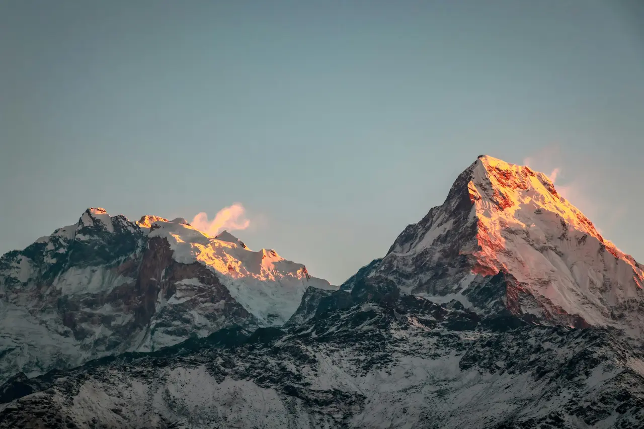
Day-by-day: 12 days
The standard Nar Phu itinerary starts and ends on the Annapurna Circuit's own access road, using the same trailhead at Koto before branching into the closed valley and returning to rejoin either the circuit proper or a direct exit to Besisahar.
| Day | Route | Distance/time | Overnight altitude |
|---|---|---|---|
| 1 | Kathmandu to Koto by jeep, via Besisahar and Chame | 9–10 hrs drive | 2,600 m |
| 2 | Koto to Meta | 6–7 hrs walking | 3,560 m |
| 3 | Meta to Kyang (Chyakhu) | 5–6 hrs | 3,820 m |
| 4 | Kyang to Phu Gaon | 4–5 hrs | 4,080 m |
| 5 | Acclimatisation day in Phu; visit Tashi Lhakhang gompa | Half-day walking | 4,080 m |
| 6 | Phu back to Meta or Nar Phedi | 6 hrs | 3,560 m |
| 7 | Meta/Nar Phedi to Nar village | 3–4 hrs | 4,110 m |
| 8 | Acclimatisation day in Nar; side trip toward Kang La base | Half-day walking | 4,110 m |
| 9 | Nar over Kang La (5,320 m) to Ngawal | 8–9 hrs, the hardest day | 3,660 m |
| 10 | Ngawal to Manang or Braga | 3–4 hrs | 3,540 m |
| 11 | Contingency/acclimatisation day, or continue the Annapurna Circuit | Variable | 3,540 m |
| 12 | Drive out via Besisahar to Kathmandu, or continue toward Thorong La | 8–9 hrs drive | — |
Two things in this table matter more than the day count. First, days 5 and 8 are not padding; they are acclimatisation days built around the jump from 3,560 m to 4,110 m and then the 5,320 m pass day, and cutting either one to shorten the trip raises altitude-sickness risk on day 9 specifically. Second, day 9 is genuinely long and technical enough that most operators build in a weather contingency day around it, because Kang La is not a pass you want to attempt in poor visibility or fresh snow. A 12-day itinerary with both acclimatisation days intact and no contingency slack is the minimum realistic length; 10-day versions sold by some agencies typically strip one of the two rest days, which this guide does not recommend at this altitude gain rate.
Porters typically carry loads only as far as the last road access at Koto or by mule beyond that point, since the terrain into Phu is too narrow and exposed in places for standard porter loads; confirm your operator's porter and mule arrangement for this specific route, since it differs from the porter-only system used on lower, wider trails.
Kang La, 5,320 m, into Manang
Kang La sits at 5,320 m and is the only realistic route connecting the Nar Phu valley to Manang and the wider Annapurna Circuit without a long retreat back down to Koto. The crossing itself runs 8–9 hours from Nar village to Ngawal, with roughly 1,200 m of ascent to the pass from Nar's 4,110 m and a long, often icy descent of over 1,600 m down the far side into the Manang valley.
The descent is the part trekkers underestimate. The Manang-side slope below Kang La holds snow and ice into the trekking season more reliably than the Nar-side approach, and a scree-and-ice traverse partway down the descent has caught out under-equipped groups in years when snow cover lingers late. A guide with specific, recent Kang La experience, not general Annapurna experience, matters here in a way it does not on most teahouse-to-teahouse days elsewhere in the region; ask directly how recently your guide has led this exact crossing, not just this general route.
Weather windows for Kang La are narrower than for most Annapurna Circuit passes. Pre-dawn starts are standard practice, aiming to cross before afternoon cloud and wind build, and a guide with route judgement will hold a rest day at Nar rather than push the crossing in marginal conditions, which is one more reason the 12-day itinerary above allows contingency slack around this day rather than scheduling it back-to-back with a fixed flight or bus connection on the far side.
Restricted permit and the 2-trekker rule
Nar Phu is a restricted area, which means the same three conditions apply here as everywhere else on that list: a registered trekking agency, a licensed guide, and a minimum of two trekkers on one shared permit application, with no individual exception at any price. As of the 2026 season, the Nar Phu restricted-area permit is charged per person for an initial block of days in the higher-fee autumn season, with a lower daily extension rate beyond that block and a reduced rate outside peak season — verify the exact current figure with a registered agency or the Department of Immigration before you commit to dates, since restricted-area fees are reviewed periodically and this guide will not print a number that risks going stale.
Alongside the restricted-area permit, most itineraries also require an Annapurna Conservation Area Project (ACAP) permit for the approach sections of the route shared with the main Annapurna Circuit trail, since Nar Phu branches off that trail at Koto rather than starting from an independent trailhead. Your agency typically bundles both permit applications into a single paperwork process, but confirm both are included in any quoted price rather than assuming the restricted-area fee covers everything. The same two-trekker minimum and agency-and-guide package applies on Nepal's other restricted valleys, including the Manaslu Circuit trek, so travellers weighing Nar Phu against Manaslu are comparing two versions of the same legal framework, not two different sets of rules.
The two-trekker minimum is the rule that actually shapes how solo travellers book this trek. A solo trekker cannot submit a Nar Phu application alone regardless of budget, guide seniority, or trekking experience; the application requires a second named trekker on the same submission. In practice this leaves three routes for a solo traveller: bring a friend who commits to the same dates, accept an agency's administrative pairing with a stranger solely to satisfy the paperwork, or join an already-organised departure where the two-trekker minimum is met by other travellers who chose this specific route and dates on purpose. The third option is the one worth taking seriously, because the fixed costs behind the permit, guide fee and jeep charter are shared identically whichever route you take to reach two people, but only a genuine group departure gives you trail company that actually matches your pace and interest in the valley rather than a stranger paired for paperwork alone.
Combining with the Annapurna Circuit
Nar Phu shares its trailhead access with the Annapurna Circuit at Koto, and the Kang La crossing rejoins the circuit's own trail at Ngawal, which means most itineraries treat Nar Phu as a loop detour off the main circuit rather than a fully separate trip. Trekkers walk the standard circuit route as far as Koto, branch north into the closed valley for six to seven days, cross Kang La, and rejoin the circuit at Ngawal to continue toward Manang and Thorong La exactly as a standard Annapurna Circuit itinerary would.
This combination adds roughly six to eight days to a standard circuit itinerary and requires the separate Nar Phu restricted-area permit stacked on top of the standard ACAP and TIMS paperwork used for the circuit itself, since the restricted-area permit does not substitute for the conservation-area fee. Budget for both permits and for the additional guide days the detour adds, since a guide's day rate for the restricted-area section typically runs at the higher end of the range used on the standard circuit given the technical demands of Kang La and the two-trekker legal requirement covering the whole party.
Some trekkers instead treat Nar Phu as a there-and-back trip from Koto without crossing Kang La at all, walking up to Phu and Nar and returning the same way to Koto rather than continuing over the pass. This shortens the trip by roughly three days and removes the technical pass-crossing risk, but it also means missing the direct link into the wider circuit, so weigh which version fits your available time and appetite for a genuinely demanding high pass before booking either version.
Lodges and food
Lodges in Nar Phu are basic, and this should be stated plainly rather than softened. Rooms are simple stone-and-timber structures with thin partition walls, shared or squat toilets in most guesthouses, and no reliable hot shower beyond a bucket heated over a wood stove in most villages; this is a materially more basic standard than the improved teahouses common on the main Annapurna Circuit or in the Everest region, and trekkers arriving with those expectations are consistently disappointed.
Food follows the same pattern as most high-altitude teahouse trekking in Nepal: dal bhat, noodle soup, instant noodles, potato dishes and simple fried rice, with menu variety narrowing the further into the valley you go and virtually disappearing beyond Phu itself. Bring your own snack bars and electrolyte supplements for the Kang La crossing day specifically, since Nar village is the last point with reliable lodge food before the pass, and nothing resembling a shop exists on the Manang-side descent until Ngawal. Wi-fi and charging are unreliable to absent beyond Meta; carry a power bank and expect to be offline for several days through the core of the valley.
Cost
A Nar Phu trip built around the 12-day itinerary above carries a mix of costs that split across a group and costs that stay fixed per person regardless of group size. The guide's day rate, the jeep charter to and from Koto, and the shared restricted-area paperwork fee an agency charges to handle the application are fixed costs for the trip as a whole; the restricted-area permit itself, the ACAP fee, and each trekker's own lodging and food for 12 days are charged per person and do not shrink as the group grows.
| Cost item | Type | Approximate share |
|---|---|---|
| Licensed guide, 12 days | Shared across group | Fixed pool |
| Jeep charter, Kathmandu–Koto–Kathmandu | Shared across group | Fixed pool |
| Agency paperwork fee for restricted-area application | Shared across group | Fixed pool |
| Nar Phu restricted-area permit | Per person | Does not shrink |
| ACAP conservation-area permit | Per person | Does not shrink |
| Lodging and food, 12 days | Per person | Does not shrink |
At the fixed pool and per-person figures above, a solo trekker administratively paired to satisfy the two-trekker minimum pays close to the full shared-cost share alone, while a departure that already has three people booked splits that same fixed pool three ways, and a fuller departure of six to eight splits it further still. The permit and food costs never move; only the shared pool does, and that pool is the largest single line item in a Nar Phu budget, which is why group size affects this specific restricted-area trek's price more, not less, than it does an unrestricted route.
FAQ
Do you need a permit for Nar Phu? Yes. Nar Phu is a restricted area, which requires a restricted-area permit, a registered trekking agency, a licensed guide, and a minimum of two trekkers on one shared application. Most itineraries also need a separate Annapurna Conservation Area (ACAP) permit for the shared approach trail from Koto.
How high is Kang La? Kang La sits at 5,320 m and is the only realistic crossing connecting the Nar Phu valley to Manang and the wider Annapurna Circuit. The crossing runs 8–9 hours from Nar village, with a long, often icy descent of over 1,600 m into Ngawal on the far side.
Can you combine Nar Phu with the Annapurna Circuit? Yes. Nar Phu shares its trailhead with the Annapurna Circuit at Koto, and the Kang La crossing rejoins the circuit at Ngawal, so most itineraries treat it as a six-to-eight-day loop detour off the standard circuit route rather than a separate trip.
Are there teahouses in Nar Phu? Yes, but they are basic. Expect simple stone-and-timber lodges, shared or squat toilets, no reliable hot showers beyond a wood-heated bucket, and a narrowing food menu the further into the valley you travel, with almost no lodge food beyond Phu itself.
Trek Nar Phu with the two-trekker rule already solved
On a restricted trek like Nar Phu, joining a departure is not the flexible option, it is often the only way a solo traveller books legally at all. NepGem's curated Nar Phu departures already meet the two-trekker minimum with people who chose this specific valley and these dates on purpose, not a stranger paired for paperwork. You see the licensed guide's licence number, altitude record and reviews before you pay, one agency handles the restricted-area application for the whole group, and the fixed guide, jeep and paperwork pool splits across everyone booked rather than landing on you alone. Arrive solo, cross Kang La with a group.


