

Everest Climbing Routes: The Two Everyone Uses, and the Sixteen Nobody Does
Roughly eighteen lines have put climbers on Everest's summit. Only two carry almost everybody — here's the camp-by-camp difference, and why the rest are barely repeated.
NepGem team · Local guides and trip planners
· 14 min read

Co-authored with an NMA-licensed climbing guide (licence no. on file) · Last verified: September 2026
Two routes carry almost every Everest summit today: the South Col route from Nepal's Khumbu valley, and the North Ridge from Tibet's Rongbuk valley. Between them, climbers have opened somewhere around eighteen named lines and major variations on Everest's three faces since the first ascent in 1953, but all but a handful have been climbed once, twice, or not since a single first ascent decades ago. If you are pricing a Nepal-side attempt, what it costs to climb Everest covers permits, operator tiers and the full expedition budget. This article is about the mountain itself: which line you would actually be on, how the two standard routes differ camp by camp, and why the other sixteen are historical footnotes rather than live options.
Two standard routes, sixteen others
A "route" on a mountain is a specific line of ascent up a face, ridge or couloir, and Everest has three broad faces to choose from: the South-West Face and South Col facing Nepal, the North Face and North Ridge facing Tibet, and the remote Kangshung (East) Face, also in Tibet. Within and around those three faces, mountaineering historians have logged somewhere around eighteen distinct lines and significant variations climbed since 1953 — the exact count depends on how strictly you split a variation from a genuinely new route, so treat it as an informed range rather than an official tally.
In practice, none of that variety matters to the roughly 800 people who attempt Everest in a typical spring season. Well over 95% of all Everest ascents, historic and current, have gone up either the South Col route or the North Ridge, because both follow the mountain's easiest available ground: broad glacier basins and moderate ridgelines rather than steep rock or serac-threatened faces. The other sixteen lines climb Everest's genuinely difficult terrain — the South-West Face's rock band, the Kangshung Face's avalanche-swept flank, the West Ridge's exposed upper section — and were opened by elite alpine expeditions, not as commercially viable routes. A handful have single ascents. Several have none in over thirty years. That split, two workhorse routes and sixteen curiosities, is the organising fact of this whole article.
The South Col route from Nepal
The South Col route climbs Everest's south side from Base Camp at 5,364 m through the Khumbu Icefall, up the Western Cwm and Lhotse Face to the South Col at roughly 7,906 m, then along the summit ridge to 8,848.86 m. It is the route Tenzing Norgay and Edmund Hillary climbed on the first ascent in 1953, and it remains the default choice for the great majority of Nepal-side expeditions.
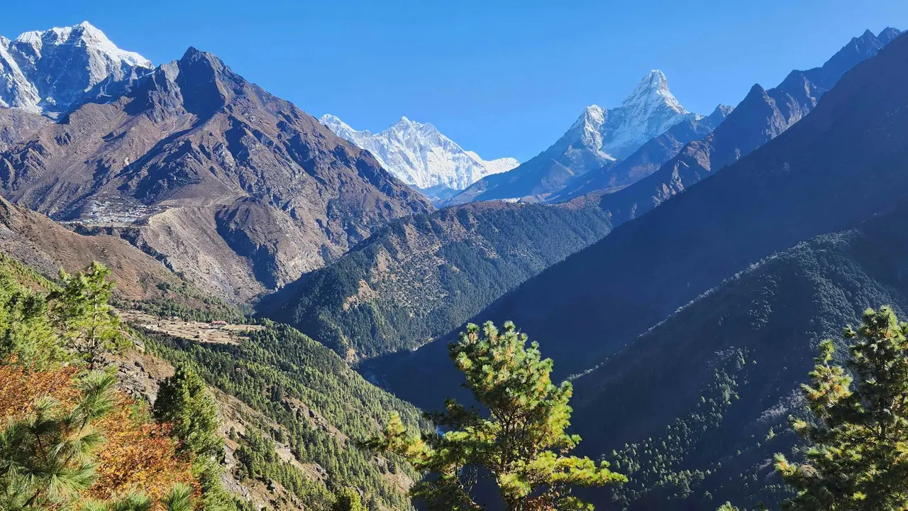
Camp by camp, the route runs roughly as follows. From Base Camp (5,364 m), climbers cross the Khumbu Icefall, a constantly shifting glacier of towers and crevasses re-roped every season by the Icefall Doctors, to reach Camp 1 (about 6,065 m) at the head of the icefall. From there the route flattens into the Western Cwm, a glacier valley walled by Everest, Nuptse and Lhotse, to Camp 2 (about 6,400 m), which doubles as advanced base camp for most teams and is where climbers spend the bulk of their acclimatisation rotations. The Lhotse Face above Camp 2 is a sustained 40–50° ice slope fixed with rope for its full length, leading to Camp 3 (about 7,200 m), cut into the ice itself with no flat ground to speak of. From Camp 3, the route angles across the Yellow Band and Geneva Spur to Camp 4 on the South Col (about 7,906 m), the last camp and the entry point to the death zone, where the body can no longer acclimatise and is only deteriorating.
The summit push from the South Col typically starts at night. Climbers pass the Balcony (about 8,400 m), a rest point on the south-east ridge, then the South Summit (8,749 m), a short exposed ridge traverse, the Hillary Step (around 8,790 m, a rock-and-snow step that was altered by the 2015 earthquake but remains a technical bottleneck), and finally the summit ridge to how tall Everest is at 8,848.86 m. The whole route, from icefall to summit ridge, is fixed with rope for its entire length by a dedicated rope-fixing team each season, and virtually every climber clips into that line rather than climbing independently.
The honest part of this section is the Icefall itself. The Khumbu Icefall is the most consistently dangerous stretch of the entire route, not because it is technically hard but because it moves: seracs collapse, crevasses open, and climbers and Sherpa load-carriers cross it dozens of times each season on the same fixed ladders. The 2014 avalanche in the Icefall killed sixteen Nepali workers, the deadliest single accident on the mountain until that point, and it is the reason expeditions now try to minimise the number of Icefall crossings per person rather than treating it as routine. Most of the climbers making those repeated crossings are Sherpa or other Nepali high-altitude workers rather than paying clients; who the Sherpa people actually are is worth understanding before you read a route description that treats them as background detail.
The North Ridge from Tibet
The North Ridge climbs from Rongbuk, on Tibet's northern side, past the North Col to the summit ridge, and it is both colder and technically harder in its upper section than the South Col route, even though it sees far fewer climbers. From Base Camp (about 5,150 m), teams move up the Rongbuk valley to Advanced Base Camp (about 6,400 m), then climb glacier and moderate snow slopes to Camp 1 at the North Col (about 7,000 m), a broad saddle exposed to relentless wind. Above the col, the route follows the North Ridge itself to Camp 2 (about 7,500 m) and Camp 3 (roughly 7,900–8,300 m, sometimes split into two camps), before the summit push tackles the route's defining feature: the First, Second and Third Steps, rock outcrops on the summit ridge at around 8,500–8,600 m. The Second Step in particular has needed a fixed aluminium ladder, installed by a Chinese expedition in 1975, since without it the step is a genuine rock-climbing move at extreme altitude with no room for error.
Fewer than a fifth of all Everest summits have come from the north, and the reason is not that Nepal's route is objectively safer — the Icefall arguably makes it more dangerous in aggregate — but that Tibet's access has been consistently less reliable. China's Tibet Autonomous Region requires all climbing to be arranged through the China Tibet Mountaineering Association (CTMA), independent trekking to base camp is not permitted, and the region has been closed to foreign climbers outright in several recent years: entirely in 2008 around the Beijing Olympics, and again through most of the COVID-19 period from 2020 into 2022, with access rules continuing to shift with little warning since. Anyone planning a north-side attempt needs to verify current Chinese entry and climbing permissions close to their departure date, not rely on a prior season's rules; this is one of the least stable variables in Everest planning and it can change a route choice outright.
Nepal vs. Tibet: cost, crowds, rescue
The two sides differ less in permit price than in what that price buys, and honestly, in how quickly you can be rescued if something goes wrong. On cost, both the Nepali government royalty and the Chinese-side permit and CTMA service fees have moved in recent years and are subject to further change; verify the current figures against Nepal's Department of Tourism and CTMA schedules before budgeting rather than relying on a number quoted here, since both have been raised more than once in the past decade.
Crowding differs sharply and predictably. Nepal's side issues several hundred climbing permits in a typical spring season, and the resulting bottlenecks at the Hillary Step and along the summit ridge have produced the queue photographs that circulate every May; Tibet's side, constrained by CTMA quotas and by the fact that fewer operators run north-side trips at all, sees a fraction of that traffic, often in the low hundreds. That makes the North Ridge notably less congested on summit day, which matters more than it sounds: on Everest, time spent queueing at 8,500 m is time spent burning oxygen and margin you do not get back.
Rescue capability is the honest differentiator, and it favours Nepal by a wide margin. On the south side, helicopters can and regularly do reach Base Camp and, in the right weather, Camp 1 and Camp 2, backed by an established Sherpa-led rescue culture and nearby Khumbu hospitals in Pheriche and Lukla. On the north side, the terrain, altitude of the approach road, and Chinese aviation restrictions mean helicopter rescue above advanced base camp is essentially unavailable in practice; an incident on the upper North Ridge is resolved by fellow climbers and Sherpa or Tibetan support staff, not by an airlift. That single fact should weigh as heavily in a route choice as cost or crowding, and it is rarely stated plainly in route comparisons written for a general audience.
The great hard routes
Beyond the two standard lines, a small number of routes represent Everest's genuine technical climbing history, and understanding why they are barely repeated tells you more about the mountain than a list of names would.
The West Ridge and Hornbein Couloir were climbed together in 1963 by Tom Hornbein and Willi Unsoeld of the American Mount Everest Expedition, who reached the summit via a narrow couloir cutting through the West Ridge's upper rock band and then descended the South Col route, completing the first traverse of the mountain. It remains one of the most celebrated climbs in Himalayan history and one of the least repeated: the upper ridge is exposed to rockfall and offers no fixed-rope infrastructure, and descending in the dark, as Hornbein and Unsoeld did, forced a bivouac above 8,500 m that both men survived only narrowly.
The South-West Face, on Everest's Nepal side but far steeper and more direct than the South Col line beside it, was first climbed in 1975 by a British expedition led by Chris Bonington, with Doug Scott and Dougal Haston reaching the summit through the face's central rock band at around 8,300 m. It has seen only occasional repeats since, including a Yugoslav ascent in 1979 and a Polish winter attempt, because the Rock Band is a genuine mixed-climbing obstacle at extreme altitude and the face above it is exposed to avalanche and falling ice from higher on the mountain.
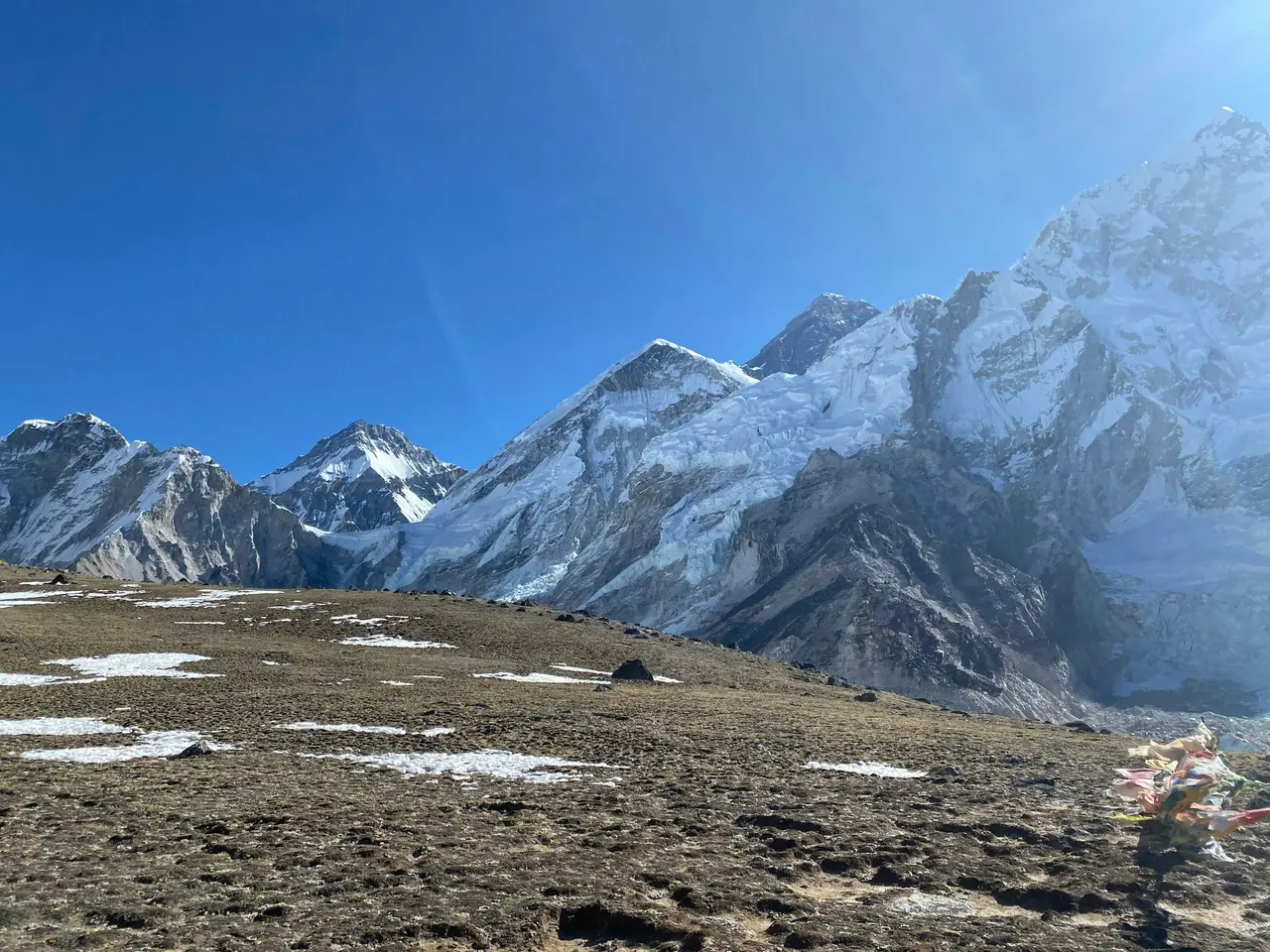
The Kangshung Face, facing east into a remote Tibetan valley with no road access, was first climbed in 1983 by an American team including Louis Reichardt, Kim Momb, George Lowe and Carlos Buhler, using fixed camps and supplemental oxygen. In 1988, a lighter three-person team including Stephen Venables climbed a new variation on the face without supplemental oxygen and without fixed camps above their high point, one of the boldest ascents in the mountain's history. The Kangshung Face has been attempted only rarely since, because its lower slopes sit directly beneath hanging seracs and are among the most consistently avalanche-swept terrain on the entire mountain.
A cluster of other named lines exist on the North Face — including the Great (Norton) Couloir, climbed solo by Reinhold Messner without oxygen in 1980, and a Soviet-opened line up the North Face's central couloir in the early 1980s — along with partial and complete attempts on the mountain's North-East Ridge. Each represents real mountaineering achievement, and each is climbed, if at all, by a handful of elite alpinists per decade rather than by any commercial operation.
What unites all sixteen of these routes is not just difficulty but the absence of the infrastructure that makes the two standard routes commercially viable. No rope-fixing team services the West Ridge each spring. No Icefall Doctors re-route the Kangshung Face's crevasses. No helicopter can reach a climber on the South-West Face's Rock Band. These routes demand elite, self-sufficient alpine-style climbing precisely because none of the systems that support 800 climbers a season on the South Col route exist anywhere else on the mountain.
What "a new route" would even mean now
A genuinely new, previously unclimbed line up one of Everest's three main faces is very unlikely at this point; most plausible independent ground on the South-West Face, the North Face and the Kangshung Face has already been tried by at least one serious expedition since the 1960s. What remains open is not blank terrain but style: a direct variation avoiding an existing line's traverses, a winter ascent of a route normally climbed only in spring or autumn, a solo ascent without supplemental oxygen on a route usually climbed with a full support team, or a faster ascent of an existing line using minimal fixed camps.
That shift already happened once, in a way worth knowing. The first winter ascent of Everest, by Leszek Cichy and Krzysztof Wielicki of a Polish expedition in February 1980, climbed the standard South Col route but in conditions — cold, wind, short daylight — that made it a fundamentally different and harder undertaking than the same route in May. Records on Everest today mostly work this way: the mountain's obvious lines are climbed, so what counts as a first is a matter of season, style, speed, or who is climbing, not a matter of unclimbed rock.
For most climbers, this is good news rather than a disappointment: it means the two standard routes are standard precisely because generations of mountaineers have already tested and rejected the alternatives as too dangerous, too remote, or too technical to run as anything other than a rare, self-supported alpine expedition. If you are choosing where to point an Everest attempt, the choice genuinely is between Nepal's South Col and Tibet's North Ridge; everything else on this page is a monument to what climbing Everest used to demand before those two routes became fixed with rope every season.
FAQ
What is the easiest route up Everest? The South Col route from Nepal and the North Ridge from Tibet are the two standard lines, and between them the South Col carries the large majority of climbers. Neither is easy: both cross glaciated, avalanche-exposed terrain above 7,000 m and finish through the death zone, where the body is actively deteriorating rather than acclimatising.
Is it cheaper to climb Everest from Tibet? It depends on the season and the operator rather than being reliably cheaper either way; both Nepal's royalty fee and China's CTMA permit and service charges have risen repeatedly in recent years. Verify current figures for both sides directly before budgeting, since older comparisons are likely out of date.
How many routes are there on Everest? Mountaineering historians generally count around eighteen distinct lines and major variations across Everest's three faces since 1953, though the exact number depends on how strictly a variation is distinguished from a genuinely separate route. Only two, the South Col and North Ridge, see regular commercial traffic.
Which side has more deaths? Nepal's south side records more total deaths because it carries several times more climbers each season, including the Khumbu Icefall's serac and crevasse hazards. Tibet's north side sees fewer deaths in raw numbers but offers far less rescue capability above advanced base camp if something does go wrong.
Climb the route with someone who has actually fixed the line on it
Route choice on Everest is not a preference you form from a comparison article; it is a decision you make with a climbing guide who has worked the specific line, in the specific season, under the specific rescue conditions you would be climbing under. NepGem's climbing guide profiles show the NMA licence number, documented altitude record and route-specific experience of the guide before you commit, so you can ask exactly the questions this article raises — how many South Col or North Ridge rotations they have led, what their turnaround call looks like at the Balcony or the Second Step, and what rescue plan actually exists above their high camp — and see a real answer rather than a marketing page. Hire the guide, not the agency: you see their licence, altitude record and reviews before you pay, on a route where that decision is the one that matters most.

