

Nepal From Terai to Tibet: The Country in Cross-Section
Nepal climbs from 60 m of subtropical plain to 8,848.86 m in under 200 km. A cross-section through its five geographic zones and what each means for a traveller.
NepGem team · Local guides and trip planners
· 12 min read

 [GEN]
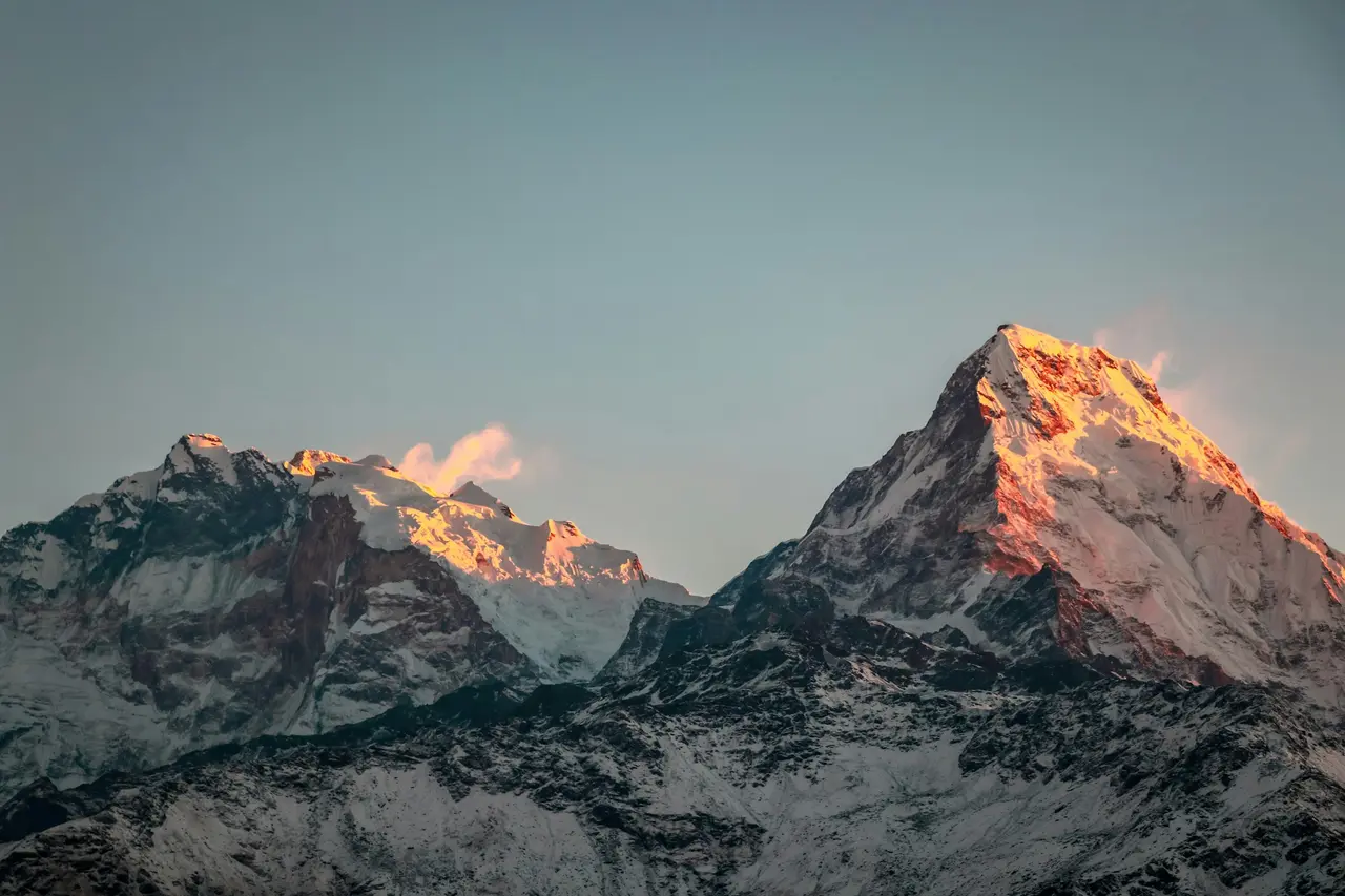
Nepal rises from about 60 m above sea level in its southern plains to 8,848.86 m at the summit of Everest, and it does this across a country only about 800 km long and, at its narrowest points, under 200 km wide north to south. No other country on Earth packs a comparable elevation range into so short a horizontal distance, and that single fact explains more about Nepal's climate, ethnic diversity, agriculture and trekking geography than almost any other. Understanding how the Himalaya formed explains why this gradient exists; this article maps what actually sits along it, zone by zone, from the sal forests of the Terai to the wind-scoured plateau edge of the Trans-Himalaya.
The most extreme elevation gradient of any country
Nepal's elevation runs from roughly 60 m in the far southern Terai to 8,848.86 m at Everest's summit, a vertical range of nearly 8,800 m within a national territory that is, at its narrowest, under 200 km across. Travel due north from the Indian border town of Kakarbhitta or the plains near Bhairahawa and you can pass through five distinct geographic and climatic zones before reaching the Tibetan plateau edge, a journey that would take you through comparable climate shifts elsewhere only by crossing several countries or many degrees of latitude.
This compression exists because Nepal sits directly on the collision front between the Indian and Eurasian tectonic plates, a boundary that has been thrusting rock upward for roughly 50 million years and shows no sign of stopping. The result is not a gentle ramp from lowland to mountain but a series of distinct steps, each with its own geology, climate and human settlement pattern, stacked one behind the other across the width of the country. A trekker walking the Annapurna Circuit or flying into Lukla crosses several of these zones in a single day, which is part of why Nepal's short treks can feel geographically dramatic in a way that longer, flatter hikes elsewhere rarely match.
Terai
The Terai is Nepal's southernmost belt, a flat, fertile plain lying between roughly 60 m and 300 m above sea level that extends along the entire length of the country bordering India. It is geologically a northern extension of the Gangetic plain, built from alluvial sediment washed down from the Himalaya over millions of years, and it carries a subtropical monsoon climate with hot, humid summers and mild winters.
Despite occupying less than a quarter of Nepal's land area, the Terai holds roughly half the country's population and produces the bulk of its agricultural output, including rice, wheat, sugarcane and jute. Cities including Biratnagar, Birgunj, Nepalgunj and Bharatpur sit in this zone, along with Chitwan National Park, whose subtropical sal forest and grassland habitat supports one-horned rhinoceros, Bengal tigers and gharial crocodiles — wildlife entirely absent from the mountain zones most trekking itineraries focus on. The Terai's ethnic makeup is distinct from the hills and mountains too, dominated by Maithili, Bhojpuri and Awadhi-speaking communities with closer cultural and linguistic ties to the adjoining Indian plains than to Kathmandu.
Summer daytime temperatures in the Terai regularly exceed 35°C between April and June, before the monsoon arrives in June and brings heavy, humid rainfall through early September; winters are mild, typically 10–25°C, and represent the most comfortable season for travellers passing through en route to Chitwan or the far-western parks. Most international flights and overland border crossings into Nepal actually pass through this zone first, which means many trekkers experience the Terai's flat, warm plains only as a transit corridor between the airport and the hills, without registering that it is a distinct geographic and cultural region in its own right rather than simply "the lowlands before the mountains start".
 [PHOTO]
Siwalik and Inner Terai
Immediately north of the flat Terai plain, the land rises abruptly into the Siwalik Hills (also called the Churia range), a young, geologically unstable belt of low mountains typically 700–1,500 m high, made of soft, easily eroded sedimentary rock that is among the youngest in the entire Himalayan uplift. Because this rock is so recently formed and so poorly consolidated, the Siwalik belt is prone to landslides and river-bed shifting in a way the older rock further north is not, and roads through this zone need frequent, expensive maintenance.
Between the Siwalik Hills and the higher Mahabharat range that follows immediately north lie the Inner Terai valleys — flat-bottomed basins such as the Chitwan, Dang and Surkhet valleys that share the Terai's warm climate and agricultural fertility but sit tucked between hill ranges rather than open to the Indian plains. These valleys were historically malarial and only lightly settled until mid-20th-century eradication programmes made them viable for large-scale resettlement, which is why several Inner Terai towns show comparatively recent, planned settlement patterns rather than the centuries-old village structure typical of the hills above them.
The Mahabharat range itself, typically 1,500–2,700 m, forms a second, older and more stable ridge system than the Siwalik belt, and most of the highway routes connecting the Terai to Kathmandu Valley have to switchback through one of a handful of viable passes across it. This is the geographic reason overland journeys from the Indian border to Kathmandu take the better part of a day even though the straight-line distance is often under 150 km: the road is climbing and descending two separate hill systems, not travelling across flat or gently rolling terrain.
Middle Hills
North of the Siwalik and Inner Terai, the Middle Hills (or Pahad) zone rises to roughly 700–4,000 m and forms the backbone of settled Nepal, the terraced, temperate belt where the largest share of the country's population has lived for centuries. This is Kathmandu Valley's zone, along with Pokhara, and the dense patchwork of hill villages, terraced rice and millet fields, and forested ridgelines that most people picture when they imagine rural Nepal.
Climatically, the Middle Hills carry a temperate, monsoon-influenced climate with four distinguishable seasons, warm enough at lower elevations for subtropical crops and cool enough at the upper edge, around 2,500–3,000 m, for temperate forest and terraced barley and potato farming. Kathmandu Valley itself, at roughly 1,400 m, sits near the middle of this range and experiences a genuinely temperate climate year-round: warm summers rarely exceeding 30°C and winters cool enough for occasional frost but almost never snow at valley floor level.
Ethnic and linguistic diversity peaks in this zone: Bahun and Chhetri communities dominate many mid-hill districts, while Gurung, Magar, Tamang, Rai, Limbu and Newar communities each hold distinct cultural and linguistic identities tied to specific valleys and hill ranges. The Newar communities of Kathmandu, Patan and Bhaktapur developed one of South Asia's most distinctive urban civilisations within this zone, with temple architecture and festival calendars that reflect centuries of settled valley life rather than the herding-and-trade economies typical of the higher zones. Several of Nepal's most popular short treks, including the Kathmandu Valley rim trek and Nagarkot's sunrise ridges, stay entirely within this Middle Hills zone without approaching the true high mountains at all.
 [PHOTO]
High Himalaya
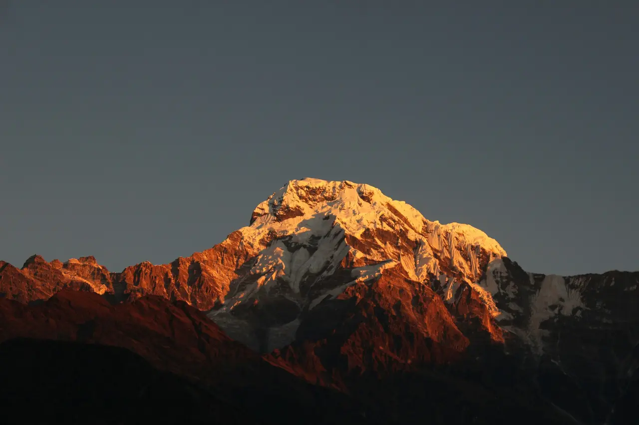
The High Himalaya zone begins where the Middle Hills give way to permanently snow- and ice-capped terrain, roughly above 4,000–5,000 m, and this is the zone containing all eight of Nepal's 8,000 m peaks, including Everest at 8,848.86 m, Kangchenjunga, Lhotse, Makalu, Cho Oyu, Dhaulagiri, Manaslu and Annapurna I. It is a narrow band by area, but it is the zone almost every international trekking itinerary in Nepal is ultimately built around.
Human settlement in the High Himalaya is sparse and specific: Sherpa communities in the Khumbu around Namche Bazaar (roughly 3,440 m), Manangi communities in the Annapurna region, and similar high-altitude ethnic groups elsewhere have adapted over centuries to an environment where farming is limited to a short growing season and short-distance trade, herding and, more recently, tourism form the economic base. Climate here is alpine to nival: below-freezing temperatures for much of the year above 4,500 m, minimal precipitation as snow rather than rain, and an atmosphere thin enough that altitude sickness becomes a genuine medical risk for lowland-adapted travellers moving through too quickly. Everest Base Camp, at 5,364 m, and Kala Patthar, at 5,644 m, both sit within this zone.
Oxygen availability, not just temperature, is what genuinely separates this zone from everything below it. At sea level, air contains roughly 21% oxygen at a partial pressure the human body has evolved to use efficiently; by 5,364 m, atmospheric pressure has fallen enough that each breath delivers roughly half the oxygen molecules of an equivalent breath at sea level, which is why acclimatisation days, not fitness alone, determine whether a trekker reaches Everest Base Camp comfortably or turns back with symptoms of acute mountain sickness. This physiological threshold, more than any visible change in landscape, is the real boundary of the High Himalaya zone for a travelling body, even where the geographic boundary on a map looks more gradual.
The Trans-Himalaya
North of the main Himalayan crest, in the rain shadow cast by the highest peaks, lies Nepal's Trans-Himalayan zone: a cold, arid, high-altitude desert climatically and culturally closer to the Tibetan plateau than to the rest of Nepal. Upper Mustang, with its walled capital Lo Manthang at roughly 3,840 m, is the clearest example, along with parts of Dolpo and the upper Manaslu region around Nar Phu.
Because the main Himalayan range blocks most monsoon moisture from reaching this zone, annual rainfall here is a fraction of what falls on the Middle Hills just one range further south, producing a landscape of eroded ochre cliffs, sparse scrub vegetation and irrigation-dependent barley farming rather than the terraced green hillsides typical elsewhere in Nepal. Tibetan Buddhist culture dominates, with monasteries, chortens and prayer-flag-strung passes forming the visible cultural landscape, and the region's historical isolation, reinforced by its status as a restricted area requiring a special permit, has preserved building styles and social structures that have changed relatively little over centuries compared with more accessible parts of the country.
 [GEN]
What this means for a traveller
Nepal's elevation gradient is not just a geography lesson; it directly determines what clothing, itinerary pacing and cultural expectations apply on any given day of a trip, because climate, ethnicity, language and agriculture all shift together with altitude rather than independently.
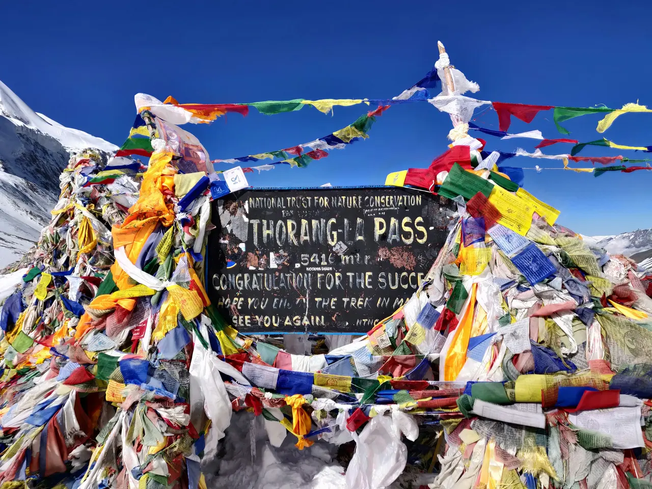
A traveller flying from Kathmandu (roughly 1,400 m) to Lukla (2,840 m) and trekking to Everest Base Camp (5,364 m) crosses from Middle Hills temperate forest through high-altitude Sherpa villages to nival, near-barren high-mountain terrain in under two weeks, with the crop staples shifting from rice and maize at lower elevations to potato, barley and buckwheat higher up, and the dominant language shifting from Nepali to Sherpa dialects and Tibetan-influenced speech near the highest villages. The same pattern holds on the Annapurna Circuit, where crossing Thorong La at 5,416 m takes travellers from the temperate Marsyangdi valley on one side to the arid, Trans-Himalayan Kali Gandaki valley and Upper Mustang's edge on the other, a climatic and cultural transition as sharp as anything on the Everest side.
Packing and acclimatisation planning both need to account for this compression. A trek that starts in Terai or Middle Hills warmth and ends in High Himalaya cold is not simply "getting colder as you go higher" in a gradual sense; it typically involves at least one sharp transition, often over a single day's altitude gain, where lowland clothing becomes inadequate within hours. Understanding which zone you will be sleeping in each night, not just the day's peak altitude, is the more useful planning question for most itineraries.
FAQ
What are Nepal's geographic regions? Nepal has five main geographic zones running south to north: the Terai plain, the Siwalik Hills with Inner Terai valleys, the Middle Hills, the High Himalaya, and the Trans-Himalayan zone in the rain shadow beyond the main range. Each has a distinct climate, elevation band and ethnic settlement pattern.
What is Nepal's lowest point? Nepal's lowest point is in the Terai plain, at approximately 60 m above sea level near the far south-eastern border with India. This is also the country's most densely populated and agriculturally productive zone, despite the popular image of Nepal as an entirely mountainous country.
How wide is Nepal? Nepal is roughly 800 km long east to west but only about 90–200 km wide north to south depending on location, which is why its elevation gradient from 60 m to 8,848.86 m is compressed into such a short horizontal distance compared with other mountainous countries.
Why is Nepal's climate so varied? Nepal's climate varies dramatically because altitude changes faster, over shorter horizontal distances, than almost anywhere else on Earth. A single day's travel can move you from subtropical Terai heat through temperate Middle Hills forest to alpine or nival High Himalaya cold, producing climate zones that would normally require crossing thousands of kilometres of latitude.
Arrive solo, trek through every one of these zones with company
Most travellers only ever see one or two of Nepal's five geographic zones — the Middle Hills around Kathmandu and Pokhara, perhaps the High Himalaya on a single trek. A longer itinerary that genuinely crosses several zones, such as an Annapurna Circuit or Manaslu Circuit route running from temperate valley to Trans-Himalayan desert and back, is a bigger commitment to plan alone, from transport logistics to acclimatisation pacing across very different climates in the same trip. NepGem's departures let you join a fixed date where a guide has already planned that zone-by-zone transition, with a group forming around the same route so you are not solving the logistics of five climate zones by yourself. If you are flexible on dates and would rather arrive solo and trek with people already booked on the same itinerary, browse open group departures that cross these zones rather than staying in just one.


