

How Tall Is Everest? 8,848 m to 8,848.86 m
यो कथा अहिलेलाई अङ्ग्रेजीमा मात्र उपलब्ध छ।
Everest's height has been recalculated at least six times since 1856. The current figure, the measurement methods, and why the number kept moving.
NepGem टोली · स्थानीय गाइड र यात्रा योजनाकार
· १२ मिनेट पढाइ

The answer
Mount Everest is 8,848.86 m (29,031.7 ft) above sea level, the official height jointly announced by the governments of Nepal and China in December 2020, following a joint resurvey using GPS receivers carried to the summit and ground-penetrating radar to measure the depth of snow and ice sitting on top of the rock. That figure replaced two competing numbers — Nepal's long-standing 8,848 m and China's separately measured 8,844.43 m rock height — that had coexisted awkwardly on maps and in reference books for over a decade.
The short version of why the number has moved at all: surveying technology has improved dramatically since the first calculation in 1856, the summit carries a variable depth of snow that different surveys have measured, included or excluded differently, and the mountain itself is not perfectly static, gaining a few millimetres a year from the same tectonic collision that built the Himalaya in the first place. None of those explanations makes any single historical figure "wrong" for its time; each reflects the best measurement available with the instruments then in use. Everest is also one of Nepal's eight peaks above 8,000 m; see the full Nepal 8,000 m peaks list for how the other seven compare in height and difficulty.
1856: Peak XV and the Great Trigonometrical Survey
Everest's height was first calculated in 1856, using trigonometric observations collected years earlier from stations up to 190 km away in the Indian plains, since the peak itself was inaccessible to direct survey teams inside Nepal at the time. The Great Trigonometrical Survey of India, the colonial-era project mapping the Indian subcontinent by triangulation, had recorded angular measurements to an unnamed Himalayan peak then catalogued only as "Peak XV." The task of turning those raw angles into an actual height fell to Radhanath Sikdar, an Indian mathematician and the survey's chief computer, who calculated in 1852 that Peak XV was the highest point on Earth, at what the survey office rounded to 29,000 ft.
The often-repeated story is that Andrew Waugh, the Surveyor General who announced the figure in 1856, worried that a perfectly round 29,000 ft would look like an estimate rather than a precise measurement, and so published 29,002 ft instead — coincidentally close to the truth, whether or not the anecdote about the extra two feet is itself entirely accurate. Waugh also gave the peak its English name at this point, choosing not a local name but "Mount Everest," honouring his predecessor Sir George Everest, the previous Surveyor General, despite Everest himself never having seen the mountain or taken part in the survey that named it.
Sikdar's own contribution is often understated in the popular version of this story, which tends to credit Waugh alone. Sikdar worked through the compass bearings and vertical angles recorded from six separate observation stations on the Indian plains, correcting for atmospheric refraction, the curvature of the Earth and the varying distance and elevation of each station, before arriving at his figure. That he could identify, from raw plains-level survey data and without ever seeing the peak up close, that an obscure, unnamed mountain was the highest point on the planet is itself one of the more remarkable feats of nineteenth-century applied mathematics, carried out with logarithm tables and hand calculation rather than any computing aid.
Why the number kept changing
Four separate factors explain why Everest's officially quoted height has shifted repeatedly since 1856, and understanding them matters more than memorising any single figure.
The most visible factor is snow versus rock. Everest's summit carries a cap of snow and ice whose depth varies with the season and with long-term climate, and different surveys have measured, and reported, different things: the height of the snow surface a climber actually stands on, or the height of the bedrock beneath it. Historically, Nepal's published figures included the snow cap while China's included only rock, which alone accounts for several metres of apparent discrepancy between the two countries' numbers for decades.
The second factor is the reference surface itself. "Height above sea level" requires a defined sea-level datum, and geodesists use a mathematical model of the Earth's shape, called a geoid, that approximates mean sea level everywhere, including thousands of kilometres from any actual ocean. Refinements to that geoid model, and to the satellite and gravity data feeding it, shift calculated elevations even when the summit itself has not moved at all.
The third factor is instrument precision. The 1856 figure came from angular triangulation over long distances with no satellite positioning of any kind. By the late twentieth century, GPS receivers could be carried to the summit directly, and by 2020, GNSS (the broader satellite-navigation category including GPS, and China's BeiDou and Russia's GLONASS systems) receivers combined with ground-penetrating radar for snow depth produced a far more direct measurement than any triangulated estimate ever could.
The fourth factor is genuine physical change: tectonic uplift, discussed in more detail below, means Everest's true height is not a fixed constant to begin with.
These four factors interact rather than acting independently, which is part of why resolving the dispute took a joint project rather than either country simply re-measuring alone. A more precise geoid model changes the baseline everything else is measured against; a better GNSS fix on the summit is only as good as the snow-depth measurement used to separate the ice cap from the rock beneath it; and neither figure settles a genuine disagreement about method unless both countries agree in advance on which quantity — sea-level snow height, in the end — they are jointly trying to measure.
1954, 1975, 1999, 2005, 2020
| Year | Height announced | Surveyed by | Snow or rock |
|---|---|---|---|
| 1856 | 29,002 ft (~8,840 m) | Great Trigonometrical Survey of India | Estimated peak height, method predates the distinction |
| 1954 | 29,028 ft (8,848 m) | Survey of India | Snow height; became the long-standing "official" figure |
| 1975 | 8,848.13 m | Chinese survey team | Rock height, with a correction for the snow cap noted separately |
| 1999 | 8,850 m | American/National Geographic Society GPS survey (led by Bradford Washburn) | Snow height, measured by a GPS unit left on the summit |
| 2005 | 8,844.43 m | Chinese Academy of Sciences resurvey | Rock height only, explicitly excluding snow and ice |
| 2020 | 8,848.86 m | Joint Nepal–China survey | Snow height, from GNSS positioning plus radar-measured snow depth |
The 1954 Survey of India figure, 8,848 m, is the number most atlases, textbooks and Nepal's own official records used for the next six decades, and it remains close enough to the current figure that it was never seriously "wrong," simply less precise than what followed. The 1999 American GPS survey introduced the first widely reported figure above 8,848 m, and National Geographic adopted 8,850 m in its own maps for years afterward, while Nepal's government continued to use 8,848 m, creating a genuine, publicly visible disagreement between reputable sources rather than a settled fact.
China's 2005 rock-height figure, 8,844.43 m, was accurate for what it measured but was frequently misreported in the media as a competing "true height," when it was in fact measuring a different thing entirely from Nepal's snow-inclusive figure. That confusion, repeated in print for over a decade, is part of what made a joint resurvey worth doing. The 1975 Chinese figure sits in between the two later Chinese numbers for a straightforward reason: it reported a rock height close to the 2005 result but published a separate, higher snow-inclusive estimate alongside it, an early attempt at exactly the dual-figure transparency that the 2020 survey later formalised as standard practice.
The 2020 joint survey
Nepal and China jointly announced Everest's height as 8,848.86 m on 8 December 2020, the result of a coordinated survey effort each country had begun independently around 2017 before agreeing to reconcile their methods and publish a single figure together. A Nepali survey team's summit climb in May 2019 carried GNSS receivers to the top and held them in place for a sustained observation period, a technically demanding task at 8,849 m of extreme cold, low oxygen and limited climbing time on the summit itself.
Ground-penetrating radar measured the depth of snow and ice sitting on the rock beneath the summit, allowing surveyors to report a snow-inclusive height while also knowing the underlying rock elevation with confidence for the first time. Precise levelling and gravity measurements, extended from established sea-level benchmarks through a chain of geodetic stations across Nepal and Tibet, tied the summit measurement back to an agreed sea-level datum shared by both countries. The 2020 figure is widely regarded within the surveying community as the most rigorously cross-checked height ever produced for the mountain, precisely because it combined direct satellite measurement, radar-measured snow depth, and a jointly agreed sea-level reference in a single coordinated project rather than two separate national efforts working from different assumptions.
The Nepali survey team's task illustrates why this took until 2019 rather than happening decades earlier: setting up a GNSS receiver on a summit roughly the size of a small table, at temperatures well below minus 20°C, with only a limited window of clear weather and a climbing team already working at the physiological edge of what the human body tolerates without supplementary oxygen for extended periods, is a fundamentally different undertaking from placing the same instrument on a stable, accessible ground station. That the joint survey succeeded on the first properly coordinated attempt reflects two decades of accumulated high-altitude logistics experience on the Nepali side as much as it does the underlying surveying technology.
Is Everest still growing?
Yes, in the geological long run: current estimates put uplift in parts of the Himalaya at roughly 3–5 mm per year, driven by the same India–Eurasia plate collision that built the range beginning around 50 million years ago and that continues today. How the Himalaya formed covers that collision in full, including why it still causes the region's earthquakes. Over the roughly six-decade gap between the 1954 and 2020 surveys, that uplift alone could account for a few centimetres of genuine height gain, a small fraction of the several-metre difference between historical figures, most of which comes from measurement method rather than the mountain actually moving.
Uplift is not the only force acting on the summit. Erosion, seismic activity and the slow deformation of the crust under enormous ongoing stress work in the opposite direction, and the relationship between the two is not simple or constant. The 2015 Gorkha earthquake prompted real scientific interest in whether the sudden release of stress along the fault beneath the Himalaya might have measurably lowered parts of the range, including Everest itself; some satellite-based studies found localised subsidence elsewhere in the earthquake zone, though the 2020 joint survey's higher figure than 1954 indicates that, at the summit specifically, decades of gradual uplift comfortably outweighed any single-earthquake effect. Whether Everest gains or loses height in any given decade is a live, ongoing measurement question, not a settled one, which is part of why the geological community regards periodic resurveys as worthwhile rather than symbolic.
FAQ
How tall is Mount Everest? Mount Everest's official height is 8,848.86 m (29,031.7 ft), the figure jointly announced by Nepal and China in December 2020 following a coordinated GNSS and radar survey. It replaced two separate national figures that had disagreed for over a decade.
Did Everest's height change? The officially reported figure has changed several times since 1856, but this mostly reflects improving measurement technology and differing snow-versus-rock methodology rather than the mountain itself changing height dramatically. Genuine tectonic uplift accounts for only a small fraction of the historical variation between figures.
Is Everest getting taller? Yes, very slowly. Ongoing tectonic uplift from the India–Eurasia plate collision adds an estimated few millimetres per year to parts of the Himalaya, though erosion and seismic activity work against that gain, and the net long-term trend for the summit specifically remains an active area of geodetic study.
Who first measured Everest? Radhanath Sikdar, an Indian mathematician working as chief computer for the Great Trigonometrical Survey of India, calculated in 1852 that the peak then known as Peak XV was the world's highest point, using trigonometric data gathered by field survey teams working from Indian plains stations far below.
Is Everest the tallest mountain on Earth? Everest is the highest point above sea level, at 8,848.86 m, but it is not the tallest mountain measured base-to-peak. Hawaii's Mauna Kea rises roughly 10,200 m from its base on the Pacific Ocean floor to its summit, most of it underwater, making it taller by that different measure even though its peak sits far lower above sea level than Everest's.
Sources
- Government of Nepal, Survey Department, and China's Ministry of Natural Resources / National Administration of Surveying, Mapping and Geoinformation — joint announcement of Mount Everest's revised height, 8 December 2020.
- Survey of India, Great Trigonometrical Survey records (1856) — the original Peak XV computation attributed to Radhanath Sikdar, and Andrew Waugh's subsequent naming and publication of the height.
- National Geographic Society / Bradford Washburn, 1999 Everest GPS summit survey, widely reported at the time as producing the 8,850 m figure later used in National Geographic's own cartography.
Trek to see it for yourself
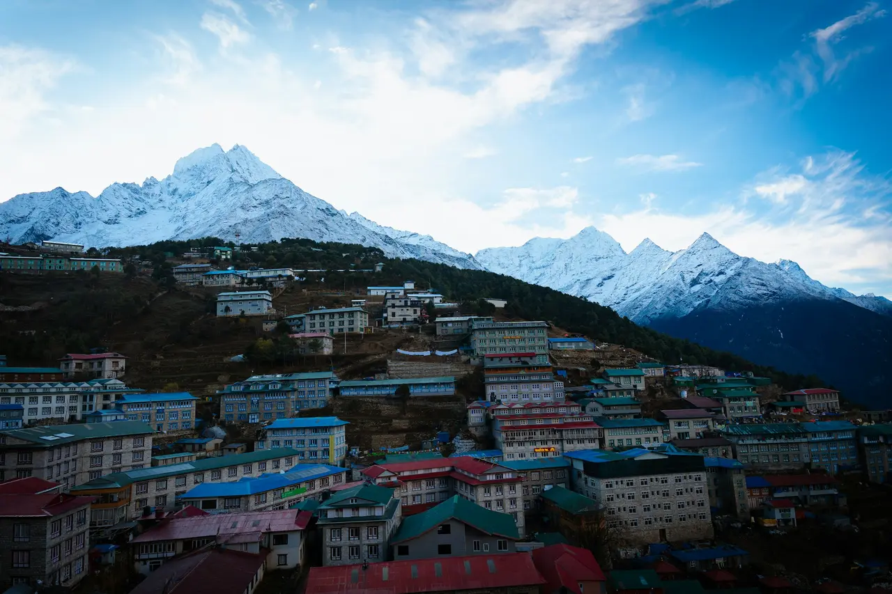
There is no substitute for standing at Kala Patthar or Everest Base Camp and looking at the summit whose height took 170 years and three countries to agree on. A shared NepGem departure to the Khumbu splits the guide's fee and shared logistics across everyone booked on the same dates, so the price on the departure page falls as more trekkers join rather than staying fixed the way a standard package quote does. If the history above has you more interested in the climbing side of the mountain than the trekking side, what it costs and takes to climb Everest itself covers the permit fees, route options and realistic budget for that far larger undertaking, and the first ascent in 1953 tells the story of the two men who reached this exact summit seven decades before its height was finally settled.


